Finnish BIM Requirements for Infrastructure 2015 Released

Finnish BIM Requirements for Infrastructure 2015 Released


The Common InfraBIM Requirements 2015 are Moving Finnish Infra Industry Forward

The first 7 parts of the guidelines for infrastructure information modelling were released on 5th of May 2015. The publisher and developer behind it is the buildingSMART Finland’s infrastructure business group – including, but not limited to: Finnish Transport Agency, large Finnish municipalities, construction companies, consultancies and technology companies. Also Infrakit is a part of the buildingSMART Finland operations and yours truly is a deputy board member of the infrastructure business group.

The development and publishing of the InfraBIM Requirements are moving Finnish infra industry forward and now the possibilities are there for a leap in productivity. It is now up to the industry itself on how it will implement the guidelines and the responsibility lies on the project owners. If the requirements are referred in the requests for tender, they will be widely taken into execution thus enabling a potential for increasing performance. The Finnish model is also recognized abroad, which I see is the most advanced model out there – even if there is still a lot of room for improvements. The world will never be 100% perfect as these guidelines won’t be either, but even with this much the guidelines enable us to take the construction industry to the next digital level.

Open Formats as a Requirement

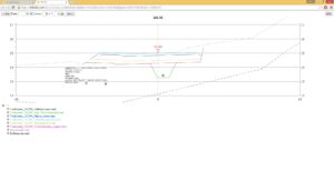
In part 2: “General requirements” open formats is the first thing mentioned and highlighted: “It is an absolute requirement to use open formats as a default”. This is the core of the guidelines that enables the development of innovative solutions. A good example of these possibilities is the use of pipe models (IM3 PipeNetworks), which enable data sharing from the designer to the on-site machine control systems and installation crew’s tablet devices.
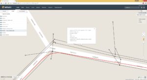
IM3 -pipe model in Infrakit
The guidelines are written on a high abstraction level on purpose so that different software and operatives can execute them in their own way. Using the InfraBIM Requirement model and Infrakit industry players can easily succeed in the transition towards digital construction. Next week I will publish another post on how Infrakit makes the initial data gathering phase easier for the project owner and the design engineer with the use of Requirements part 3: “Requirements on initial information”.

The InfraBIM Requirements 2015 will be soon published in English, in the meanwhile read the article about it here.

Book a Demo

Discover how Infrakit connects your entire infra project operations and drives value to every part of your business.
Infrakit Android App

Infrakit Android App

Infrakit Android App available at Google Play!

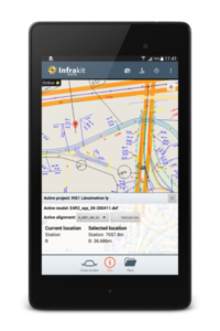
You can find the new Infrakit App from Google Play with keyword Infrakit. This is a beta version of the new app that you can use to browse your Infrakit models, alignments and background maps on your Android mobile device. The app has a new camera feature which allows you to take photos on site. The photos are then linked to your location and will show on Infrakit map as icons. Taking photos is available also in offline mode so you don’t need network for taking photos in areas with bad connection. When you go back online the photos are automatically synced to Infrakit.

User interface from June 2015

Infrakit Android App now supports the direct use of GNSS receivers such as Javad Triumph-2, Javad Triumph-1, Trimble R10 and Topcon GR-3. You can use the external receiver with the Infrakit app and make measurements and validations with your precise location. The technology behind it is that a connection is established between the GNSS receiver and Infrakit App via Bluetooth, which allows integration development with other receiver manufacturers in the future. If you have another receiver in use, please let us know and we will build the support for it too!

The core purpose of the app is to provide management and surveying staff a tool alongside the web service to extend the benefits they get from using Infrakit on-site. Now they can access the design data and maps faster and easier while adding comments and pictures to notes while terrain visits. Soon the app will have a new user interface and layout, which makes the use even more effortless.

Edit. 2nd of August 2016: See our newer blog post of developing the App, its surveying abilities from here (see how far we have come in a year!) and some user experiences from here.

Book a Demo

Discover how Infrakit connects your entire infra project operations and drives value to every part of your business.

Infrakit and Initial Information Models

Infrakit and Initial Information Models


Carefully gathered and applicable initial data models is the cornerstone of infrastructure projects

Initial data that is both solid and usable is the precondition for a project to succeed within budgeted costs. Poor-quality initial data lead to poor-quality designs and from there to additional costs and delays in schedule in the construction phase.

The Finnish National InfraBIM Requirements 2015 part 3: “Requirements on Initial Information” is about gathering and harmonizing initial data into an easy-to-access digital material: initial information model. The guidelines describe the best practices related to the initial information model, but it also leaves room to implement it with various software solutions.

The raw material for the model is procured through multiple sources, for example: different registries and terrain measurements. The raw material is handled and then formed into the model by harmonizing the material into open formats and to the modern coordinate system (typically ETRS in Europe).

Example harmonizing the material:

A single InfraModel3 mesh model is transformed from a 2D map of water maintenance material (built from multiple DWG files) — National InfraBIM guidelines 2015

Finally the harmonized material – initial infomation model – consists of a group of open format files, which portray the desired area clearly for the design phase. At the moment the most used open format file types in Finland are InfraModel3/LandXML, GT file, DWG/DXF and IFC. As an addition to the model files itself, a model description in text form (Word or PDF) is linked to the initial information model, which reports the accuracy of the initial data and executed editing procedures.

Utilizing Infrakit

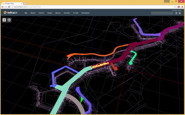
The best way to gather initial data and constructing the initial information model is to use Infrakit. Initial data model is gathered, which includes the 3D material and the required reports in folder structure approved by InfraBIM guidelines. On Infrakit the model is easy to view on map and 3D display. The designer in the next phase can download it on his computer as a whole or file-by-file to be used in any design program.

3D view on Infrakit.

Infrakit manages harmonized material checking. For example the success of coordinate conversions can be visually checked. You can also check that the material is successfully transcribed into an open format file type from the original design system. With Infrakit the designer or the project owner can verify the initial information model quality assurance. For the project owner the finalized model is easy to procure and validate as well as easily applicable in the next phase.

You can read my previous post about the InfraBIM guidelines here.

Book a Demo

Discover how Infrakit connects your entire infra project operations and drives value to every part of your business.
Promotion of Adriatic Almanac for Civil Construction

Promotion of Adriatic Almanac for Civil Construction

Infrakit participated in promotion of regional Almanac for year 2015/2016.

The Almanac – PUT plus – is becoming popular in ex-Yugoslavian markets, because it is one of its kind. It is good mix of academic, professional and commercial texts. Structure of the almanac is a combination of a magazine and a catalogue. Introduced in this issue are some of the biggest companies from the civil engineering sector in the region.

Infrakit introduced itself with article spread over three full pages. Concerning a small initiative about new technologies in Balkan civil construct sector, we consider that it was important to participate in the almanac, too. We explained the benefits of Infrakit application as a part of BIM platform, and passed knowledge about advantages of 3D guidance machine control systems and how Infrakit helps out every participant in construction process.

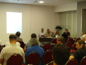
Event took place on 24th of July in Park Hotel in downtown Belgrade. We had a chance to meet all the event participants, consisted mostly from the representatives of the companies introduced in the almanac. We made contacts, gave out our promotional material and arranged further meetings with some of them. All in all, my impression is that guests also wanted to get to know each other since there is no big regional association gathering for civil engineering market, promotion was a good event for networking and we made valuable contacts there.

Although almanac has about 300 pages, it is easy to browse through and interesting to read. About 60 regional companies from civil construction sector took part in this second issue of the almanac, some with advertisements, and some with academic columns. The number of road and railroad construction companies is significantly higher in this issue than before. Almanac is very welcomed as a way to make up lack of communication and big events from the field in the region.

You can read the PUT Plus article here (in Serbian): PUT Plus – Infrakit

Book a Demo

Discover how Infrakit connects your entire infra project operations and drives value to every part of your business.

INTERMAT Paris 2015 Exhibition

INTERMAT Paris 2015 Exhibition

This April Teemu and I visited the Intermat Exhibition in Paris for 2 days. Our main goal was to talk with the major manufacturers for machine control systems and to see what kind of possibilities there are in the European market for Infrakit. It was interesting to see that there were not many software-related companies exhibiting at this fair, I would have expected otherwise as digitalization is such a huge trend nowadays.

We were able to talk with all companies that are active in the machine control business and very good talks they were indeed. All of those parties agreed with the fact that open communication will be demanded by customers in the near future. Openness and interest to companies like Infrakit will be a topic for the upcoming years. Some admitted that this is already necessary right now.

Another issue we noticed was that the machine manufacturers are now offering more and more machine control systems that are build-in from the factory. They see the growing demand for this and build-in from factory has many advantages. Especially cables are much better protected than when the systems are installed after delivery or on existing machines. This gives the customer a more reliable system as a whole.

From the conversations with these manufacturers we found out that they also see there’s a good market for open communication – as with Infrakit. At the same time it is necessary for them to make a well-thought choice of brand. Most of them have already made such a choice, which results in the fact that they have chosen between either Trimble, TopCon or Leica.

Furthermore we had contact with several companies supplying software or service for infra design. These companies are very interesting as to see what kind of cooperation we might have with them in the future.

All in all it was a successful exhibition for us and for Infrakit’s future in the international markets. Can’t wait to see what the next Intermat event has to offer.

Book a Demo

Discover how Infrakit connects your entire infra project operations and drives value to every part of your business.