“Infrakit is unmissable in our present-day work”
Jan Boerman, land surveyor at Dunnewind Groep in Ommen
He is an “old hand” in the trade. Jan Boerman works, among his other jobs, as a land surveyor at Dunnewind Groep in Ommen. The company specializes in earthworks, civil engineering, demolition projects, transport, and waste collection. With an employment history that started as a crane operator, Boerman moved into the role of surveyor after first being a contractor. The now 60-year-old expert still enjoys his profession, which cannot be called an everyday job. It is no wonder that one can also spot Boerman as a guest lecturer at BOB Zondag in Bruchem and at Zone College in Zwolle. Mentoring trainees at Waterschap Regio Delta Zwolle, among others, is also something he enjoys. Boerman loves his trade and makes every effort to innovate himself. This is why we spoke to him about Infrakit’s role at Dunnewind Groep.
The era before Infrakit
“To explain the power of Infrakit, it is important to know how everything worked before Infrakit started helping us,” Boerman opens the conversation. “As an example, I’ll talk to you about sewerage. We used to have to re-measure new structures on-site every two days. This was very labor-intensive, not only in terms of hours on-site and travel time, but also in terms of administration. Those same records then had to be distributed to everyone who needed access to them for the project. If someone was not paying attention for a moment, it could just happen that an outdated drawing was used.”
“For Boerman, it is clear that Infrakit pays for itself.”
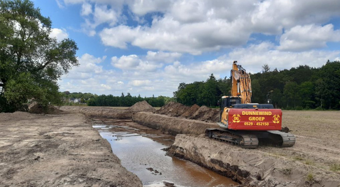
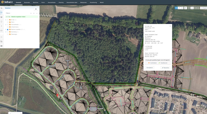
With the arrival of Infrakit as a centralized source of information, everything now works much faster and more reliably, Boerman continues. “Infrakit is a ‘Single Source of Truth’,” he says. “In the latest version, measurement data is instantly and centrally available to anyone who needs or is allowed to access it. Adding and accessing data is done in the most direct way – via the cloud. And easily, ‘in the field’.” As an example, Boerman talks about linking Infrakit with the 3D machine controls of the crane: “Our Leica GPS unit on the crane links measurement data back to Infrakit. This, in turn, is linked to the 3D machine controls on the crane. I can remotely call up the points measured by the crane via Infrakit, as the operator can take point measurements during excavation work. This way, we monitor the process and can also adjust it remotely, if needed. All data is immediately available via Infrakit.”

By air
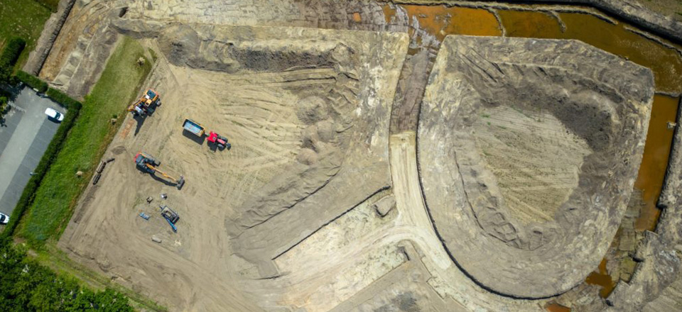
The level of progress is notable when Boerman talks about Dunnewind Groep’s deployment of drones. “We fly a drone into the field, or rather, over it. With the data the drone scans in, a lot can be done. Using AutoCAD, it can be turned into line data according to NLCS standards. This produces very accurate drawings – accurate to the centimeter. We store these drawings within the relevant project at Infrakit to be used by anyone who needs to work with them. With the drone technology, we can also make volume calculations for earthworks and use them as a foundation in Infrakit. Many different kinds of analysis can be created based on the data generated by the drone. Contractors can use this data through Infrakit and, thus, have a wide variety of information available to them relevant to the project. One can conveniently view, for example, the status of any given project. Again, the system works as the ‘Single Source of Truth.’ You literally see ‘the latest news’ about your project. How wonderful is that?”
Infrakit pays for itself
For Boerman, it is clear that Infrakit pays for itself. “Having reliable data at your disposal at any time and in any location is all you need. Working this way saves one man, in my estimation, 20 hours of work per week. I personally use Infrakit on a tablet with a GPS antenna. It works to the centimeter and I can feed the data into Infrakit. With this, I directly eliminate an entire series of administrative operations. I save time, and data is immediately available to anyone who needs to work with it. Having been working with a crane myself, I know this makes a huge difference, and I know what the people in the field need. For Dunnewind Groep, working with Infrakit is not only a huge step forward on the company level but also a benefit to our customers. Transparency is key in today’s times. Reliability of data is becoming increasingly important. With Infrakit, Dunnewind Groep can offer its customers a service that has simply not been available before. A quick access to accurate and continuously updated data. We can forget about discussions regarding measurements. Everyone benefits from this.“

Book a Demo
Discover how Infrakit connects your entire infra project operations and drives value to every part of your business.
