Infrakit in a Pilot Collaboration with Estonia’s Road Administration
Infrakit in a Pilot Collaboration with Estonia’s Road Administration

Infrakit is in use in many different infra projects around the world. We operate in nine different countries: Finland, Estonia, Sweden, Norway, BeNeLux countries, Germany, France, Australia, and Serbia. Usually BIM projects are started by piloting Infrakit to see how it works and can be used.
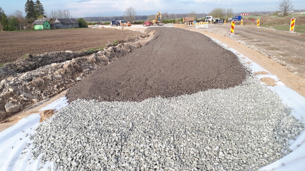
Picture from Road nr 25 Mäeküla, Estonia – project construction works, picture taken by Mikk Mutso, the site supervisor Esprii OÜ

For a great example of our pilot projects, Infrakit Estonia’s Country Manager Ingmar Aija has worked with Estonia’s Road Administration, and he had the privilege of talking with Estonian Road Administration’s Project Manager Erko Puusaag.

Here is how Puusaag describes piloting Infrakit in their recent infra project:

“The first two years of piloting have been completed and we will take the next step and create common technical requirements for the design and construction of BIM projects; we can rely on the experience of both ourselves and other pilots (Tallin Harbor, Rail Baltica)”. Puusaag continues, that specialists from all regions of the Road Administration as well as the Centre are involved in the preparation of the requirements, working as a unified team. Cooperation between private and public sector continues in developing BIM requirement for procurements. An action plan is under construction on implementing BIM requirement in ERA ordered projects.


As for the Estonian Road Administration, “Infrakit has been one of the important tools used by the Road Administration to discover the world of BIM.” Puusaag sums up the piloting project.

“Infrakit has been one of the important tools used by the Road Administration to discover the world of BIM.”

Aija sees many opportunities implementing Infrakit in the Estonian infra construction business. Printing cross-sections on paper, measuring slopes manually and storing photos hectically without geolocalization in folders is not a very modern and lean way to work nowadays.
Video of Infrakit

Changing processes takes time, we know! Infrakit has solved most of the infra-construction data-flow pain points and Aija just mentioned some of those. Proper tools are ready to work with and so are we at Infrakit team to help you to gain most out of it!

Annika Helisvaara
June 26, 2020

Book a Demo

Discover how Infrakit connects your entire infra project operations and drives value to every part of your business.

Better work planning with Web Map Services (WMS)

Better work planning with Web Map Services (WMS)

Visual information management in Infrakit is built on top of map tiles. Now it is possible for our customer to directly set the desired map tile sources.

Many municipalities and public infra owners provide open data sources as web service. These Geospatial Information Systems (GIS) services follow typically standards by Open Geospatial Consortium (OGC), such as Web Map Service (WMS). The content provided from these open interfaces may include city parcels, project boundaries and nature reserves to name a few.

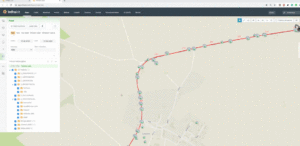
See the following video that discusses the process to enable custom map tiles in Infrakit:

With relevant map tiles the user receives actionable insight by increased situational awareness. For example, foreman can see the machine location in Infrakit together with areas read from WMS. Areas may include project boundary, aerial images, hazardous areas and areas that are prohibited to enter due to nature reserve.

Then if machine is working in such area, operator of excavator can be called back to allowed area.

Infrakit is SaaS product and WMS interface is automatically available for all current and new Infrakit users.

Anssi Johansson
June 25, 2020

Book a Demo

Discover how Infrakit connects your entire infra project operations and drives value to every part of your business.

Infrakit’s Mission is a Sustainable Infra Industry

Infrakit’s Mission is a Sustainable Infra Industry

Summer of 2018 in Finland was unheard of – and alarming. With high temperatures over 30 degrees Celsius for weeks and weeks, the effects of global warming were becoming painfully apparent. My co-founder Matti and myself were spending time at my parent’s summer house in Sipoo enjoying our well-earned summer vacation. We had succeeded in getting Infrakit off the ground, we had surpassed the first million euros in yearly revenue. Some could say we had “made it”. Despite our success and the blooming nature around us, our mood was gloomy. Global temperature and CO2 emissions were increasing each year and world leaders seemed incapable of solving or even mitigating the impending doom of climate change the world is facing. We both have kids and fear for the world we are leaving for them. We felt helpless.

It was during that day that it dawned on us – we can make a difference. We must. We figured that as business leaders we have a leverage – and a responsibility.

As we have started to look more closely on the matter, we have realized that Infrakit is in a pivotal position to enable a sustainable infra industry, not only on an ecological, but also on societal and personal levels.

DCS Finland – Teemu Kivimäki

Infrakit works for a sustainable infra industry on three levels.

Firstly, on ecological level Infrakit reduces waste in the construction process – waste means errors and downtime. This means emissions and lost money. With Infrakit, the emissions impact of machinery and materials of the projects can be measured. What can be measured can be optimized, and finally eliminated – our ultimate goal is a zero-emission infra industry.

Secondly, on societal level Infrakit enables societies to effectively build and maintain their infrastructure, in addition to increasing transparency.

Last but not least, on personal level Infrakit enabled people working on this industry to gain control over their complex projects and gives them a peace of mind when their project is running smoothly.

I invite you dear reader to join us in our mission to make this industry sustainable, we can do it together!

Teemu Kivimäki
June 24, 2020

Book a Demo

Discover how Infrakit connects your entire infra project operations and drives value to every part of your business.

What is meant by BIM? Thoughts for students and all BIM experts from our Infrakit Belgium, Netherlands and Luxemburg’s Country Manager Tiny Nuiten
What is meant by BIM? Thoughts for students and all BIM experts from our Infrakit Belgium, Netherlands and Luxemburg’s Country Manager Tiny Nuiten

As an active party in the world of InfraBIM in the BeNeLux, we often get the question: “what do you mean by BIM?” And that is quite a good question, because I often ask our customers. The abbreviation BIM has a number of different definitions and meanings. For example, I recently heard a few explanations for the abbreviation. I think Building Information Modeling and Building Information Management are the two we’ve all heard before.

Tiny Nuiten, General Manager, Infrakit Belgium, Netherlands and Luxemburg

Still, during the InfraBIM Open conference in Tampere, Finland, I heard some new ones: ‘Bad Information Management’, ‘Better Information Management’ and ‘Best Information Management’. For us at Infrakit these are the definitions we are working on, every day.

Now it is not the case that nobody thinks about this, on the contrary, entire teams are even being set up to see how they can best deal with all that data. Because it is quite a lot, from design to implementation and back. We are not only talking about 3d design files, but also about documents, photos, as built data, logistics files, asset management, approval cycles, reports, machine control files, but also about the link with external platforms that use the data in their own way. In short, everyone has their own definition, modeling and structure.

As InfraBIM experts, our goal is always to turn BAD Information management into BEST Information management, and we cannot do this alone.

As InfraBIM experts, our goal is always to turn BAD Information management into BEST Information management, and we cannot do this alone. Although our products play a central role in the overall process, we are left empty-handed without the necessary good files supplied. So InfraBIM is not something that one party can complete on its own, not even Infrakit.

Close cooperation between all parties involved is therefore essential for the success of a “BEST information Management” system. As Infrakit we do not dare say otherwise, we constantly talk to all possible suppliers and buyers (with a beautiful word stakeholders) of certain information to be able to tell in real time what the latest situation is.

These links ensure that the entire information flow is available in the right place at the right time, in the right version. We like to call this a “tool chain”. A good ‘tool chain’ is a chain of applications that all apply their own expertise to the same data set and as befits a ‘chain’, which is as strong as the weakest link.

Look, that ‘tool chain’ is of course important, we all realize that, but more importantly are the people who now learn and think about it in their studies and at work. People who are going to form and set the direction in the near or distant future. Information flows in the (sometimes confusing) world of BIM in general and that of InfraBIM in particular.

That is why it is so important for us to contribute to education where we can, to facilitate, support, inform, but also to hear everyone’s input and implement it where possible. That is the task that we constantly keep in mind, and adapt to the changing circumstances, the new ideas, the new insights and ensure that students and people already working in infra construction continue to play that central role. Your input, now or in the future, is of great importance.

Because together with you, all BIM experts out there, we can change the definition of BIM, be it Modeling or Management, as long as we can turn ‘BAD’ into ‘BEST’.

Because together with you, all BIM experts out there, we can change the definition of BIM, be it Modeling or Management, as long as we can turn ‘BAD’ into ‘BEST’. Everyone involved will be much happier.

Tiny Nuiten
May 12, 2020

Book a Demo

Discover how Infrakit connects your entire infra project operations and drives value to every part of your business.

Highlights of the new release, Infrakit OFFICE™ – Version 3.6.3

Highlights of the new release, Infrakit OFFICE™ – Version 3.6.3

Once again we are pleased to introduce many new improvements within our newest release! Highlights of the new release are listed below, and the full release notes can be accessed here.

Improvements to OFFICE

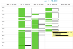
Activity charts show user a calendar view, whether the machine on field is operating or not. Together with this it shows if the machine is moving or not. Now it is possible for users to see more detailed activity chart from Topcon and Leica machines, too.

The brand-new opacity sliders can send map tiles and drawings to the background of models so models are more visible. See the video below explaining how to use this new function:

For enhanced modelling features, new version offers point information of as-planned data to be visualized on map when desired. This data could hold information like point code or elevation of the point to name a view. Infrakit can also now read several alignments on a single landXML file.
Photo management is easier with new thumbnail previews and grouping functions. New function enables downloading of photos in groups. For improved tracing of file revisions another new feature brings comments directly to the file import dialog.
Mobile improvements

Handy mobile version of Infrakit has also some nice updates. Now it’s possible to take free cross sections by using the touch screen. Using PDFs is more convenient because PDFs are opened to a full screen and PDF file tree is visible by default.

Improvements to TRUCK

TRUCK solution comes in two modes: automatic one that does not need any driver interaction and manual that requires inputs about mass haul from the driver. This setting can be set from project settings whatever suits best for workflow of your project.

Linda Hakala
April 21, 2020

Book a Demo

Discover how Infrakit connects your entire infra project operations and drives value to every part of your business.

Annika Helisvaara as a Communications Manager

Annika Helisvaara as a Communications Manager

“I am excited to become part of Infrakit’s professional team. Infrakit has a brilliant product for infraconstruction’s data management needs, and I am also eager to learn more from this evolving line of business.”

Annika Helisvaara joins Infrakit’s Marketing and Communications -team. Annika has done communications, campaigns, event organizing and general project management in her previous positions, for example at Suomen Mentorit ry. Annika has also experience in personnel assessments. She holds a Master’s degree in Social Science and is a Social Psychologist. Annika will strengthen specifically Infrakit’s internal communications, marketing and HR-functions.

Book a Demo

Discover how Infrakit connects your entire infra project operations and drives value to every part of your business.