The New Infrakit version brings more CDE features and enhanced 3D experience!
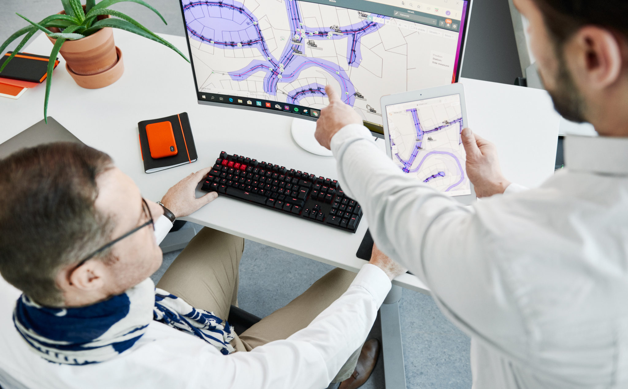
The New Infrakit version brings more CDE features and an enhanced 3D experience! 

Release blog posts may not be the most popular ones we’ve got, but we could argue that they are high value providing hidden gems for those that do open these. Seems that you are one of those pioneers, and forerunners of the industry, so congratulate yourself on being on the tip of the iceberg, by educating yourself to be the ”digitalization champion” who rides the tide!  

For release 3.8.2 of Infrakit OFFICE, we focused on making features that help manage all project documents in Infrakit, not only the ones you would visualize on the map. Together with that, we have enhanced the 3D BIM viewing. In other words, these features enable you to work faster,  collaborate better, and be the star of your project! 


Optimize your data management with new CDE features

It’s no big secret that data management is the key to successful projects. This time we focused to enhance our CDE features by adding you an opportunity to set and manage properties for your files. 

Was it either file categories of Design Disciplines, Model maturities, or phases of the project, property management saves you a ton of time. Add your custom property as a number, text value, or in a list of options. 

Check how to use it from the video below! 


Simplify your mountain of information 

Infraprojects tend to have quite an overwhelming amount of files… Thus, filtering and sorting out the ones you don’t need in the UI brings simplicity.  

To enable this step by step, we developed another CDE feature, which enables you to make any file or folder dispappear from the visualization apps.  As an example, you can use the Infrakit as single source of truth platform for all the project files. Store and manage the revisioning of the native drawings that are not meant for map projection. With this feature those files are not bugging the users of the Map page. 

We also introduced handy left-click menus on web UI, make sure you don’t miss that one! 

The video below once again will show you a quick and easy way of using this feature! 

Become a superior collaborator with enhanced 3D’s and point clouds 


Wouldn’t you want to be the champion, who makes everyone in project-wide collaboration feel happy and safe? Yea, that is precisely why (once again), we used a ton of focus on making Infrakit help you to be the champion. 

Infrakit’s high-power 3D engine can smoothly render your map and 3D data in one view on any modern hardware (yeah, that’s including phones and tablets). The 3D view now also enables you to see the station numbers of alignments, enabling finding the right spot on the project even handier. On top of these, the new version enables you to select multiple point clouds to be visualized at the same time!  

These features not only make the designs and visualizations of the site look good but you as well! 


Check the more in-depth list of new features and improvements of this version from our Knowledge Base

Jere Syrjälä
March 13th, 2023

Book a Demo

Discover how Infrakit connects your entire infra project operations and drives value to every part of your business.

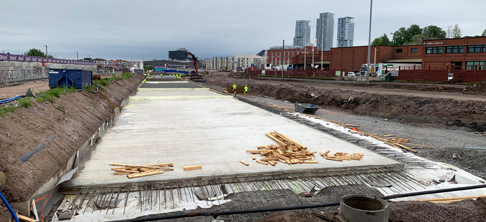
Climate Fund – €6 million capital loan to Infrakit for the development and commercialisation of sustainability functionalities for boosting emissions reductions in infrastructure building

Climate Fund – €6 million capital loan to Infrakit for the development and commercialisation of sustainability functionalities for boosting emissions reductions in infrastructure building

The Finnish Climate Fund has decided on a capital loan of up to 6 million euros to Infrakit Group Oy for the development of sustainability functionalities in their data management service, as well as for boosting the software’s international deployment. Improving the efficiency of transport and the utilisation of machines and materials can reduce the emissions of infrastructure construction sites by an estimated 5%.

Infrastructure building refers to the construction of, for example, transport routes, logistics centres, energy infrastructure or industrial structures. The sector’s annual emissions in Finland are approximately 1.4 Mt CO2eq, of which roughly 55% is generated by the fuel consumption of machinery and vehicles.

Infrakit offers data management services for infrastructure projects, particularly for reducing the duration and costs of construction. ”Until now, we have been able to promise our customers savings of approximately 20% in overall infrastructure building costs by improving the efficiency of operations with our service. Many projects have also been completed ahead of schedule, like the 70-million-euro project on Highway 3. Now we want to bring the same benefits to sustainability”, says Infrakit’s CEO, Teemu Kivimäki.

Infrakit’s sustainability function will offer more precise information and tools for boosting emissions reductions to construction companies and infrastructure managers in Finland and abroad. The service lets its users leverage climate and environmental data as well as measure and anticipate the emissions generated by their operations.

”Infrakit’s comprehensive data management service is one way of boosting the sustainability perspective in the construction sector. For example, cities and municipalities could use the service to set requirements and goals for builders regarding their emissions. Our investment accelerates the growth of an emissions-reducing solution and enables the development of new sustainability functionalities”, says CEO Paula Laine of the Climate Fund, shedding light on the reasons behind the investment decision.

Infrakit’s solution

Infrakit Group Oy is a company established in 2010 that offers cloud-based data management services to infrastructure construction sites. Infrakit’s solution has already been used in over 3,000 Finnish and international projects worth more than 30 billion euros in total.

The emissions reductions achieved by Infrakit are indirect: its technology enables the recognition of emissions but the ultimate emissions reductions depend on the corrective action taken by the company’s customers instead of directly from the technology or product of the company being financed. Infrakit’s data-based management features offer tools for determining the customer’s carbon footprint, monitoring actual emissions and optimising emissions during the project’s implementation. By using this data, Infrakit’s customers are able to decrease their emissions.

The project’s estimated emissions reduction potential is based on the improvement in infrastructure building efficiency achieved by the data model platform provided by the company, which can for example reduce the fuel consumption of machinery at the construction site. The magnitude of the emissions reductions achieved in a single infrastructure building project is approximately 0.6 kt CO2eq. If Infrakit’s business plan succeeds, its ten-year cumulative emissions-reduction potential is approximately 3 Mt CO2eq. The emissions-reduction benefits brought by the new sustainability functionality currently under development would be realised in addition to this estimate, but the assessment of their magnitude involves uncertainties, so they have not been included in the emissions-reduction estimate above. The project targets markets both in Finland and abroad but Infrakit believes that most of its growth will be achieved abroad.

The total investments in the company’s growth and development plan in the next few years are estimated at €12.6 million, consisting of the Climate Fund’s capital loan, €5 million in equity funding from one of the company’s current shareholders and grants from Business Finland and the Centre for Economic Development, Transport and the Environment.

The Climate Fund’s capital loan of up to €6 million has a convertibles option and will be allocated to the development of an emissions-reducing functionality and the acceleration of the software’s international deployment. The interest on the Climate Fund’s capital loan is priced at the market rate and the capital loan also includes a conversion right.

For additional information, please contact:
Saara Mattero, Director, Communications and Sustainability, tel. +358 400 114 777 saara.mattero@ilmastorahasto.fi

Anssi Johansson, VP of Marketing, tel. +358 40 592 9933, anssi.johansson@infrakit.com

The Finnish Climate Fund is a Finnish state-owned special-assignment company. Its operations focus on combating climate change, boosting low-carbon industry and promoting digitalisation. The Climate Fund invests in large-scale projects in which the fund’s investment is crucial to enable the project’s realisation in the first place, on a larger scale or earlier than it would with funding from elsewhere.

Infrakit – Your digital transformation partner. Infrakit is an industry-disrupting digital platform to increase infrastructure construction productivity. We are driven by the goal of a sustainable infra industry – while offering 20% savings in total project costs. Our customers include the most advanced construction companies and infrastructure owners in the world. We have been helping our customers to digitalize their infra projects since 2010 – over 30 billion euros of infra assets has been built with Infrakit in more than 3000 projects in 13 countries.

Anssi Johansson
February 8, 2023


Book a Demo

Discover how Infrakit connects your entire infra project operations and drives value to every part of your business.
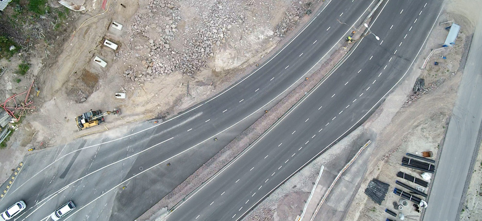
Das Kalasatama-Pasila-Projekt – ein wichtiger Schritt zur emissionsfreien Baustelle

Das Kalasatama-Pasila-Projekt – ein wichtiger Schritt zur emissionsfreien Baustelle

Emissionsziele auf dem Unternehmenslevel werden im Infrastrukturbereich immer häufiger. Auf konkrete, wichtige Schritte zur Erreichung dieser Ziele mussten wir jedoch warten.

Die hohen Ziele der Kohlenstoffneutralität können nur erreicht werden, wenn die Mittel zur Emissionsreduzierung durch konkrete Projekte entwickelt werden.

Ein wichtiger Schritt zur CO2-Neutralität

Destia, der Hauptauftragnehmer des Projekts der Kalasatama-Pasila-Allianz in Helsinki, hat zusammen mit dem Nachhaltigkeits-Team des Projekts den großen Schritt von der Ambition zur Praxis gemacht.

In Kooperation mit anderen Projektpartnern führt Destia jetzt die Emissionsüberwachung auf Basis von Produktionsdaten an, was nicht nur zu genaueren und höherwertigen Emissionsüberprüfungen führt, sondern auch einen einfacheren Prozess für die Erstellung von Überwachungsdaten darstellt.

Von der Schätzung zur Überprüfung von Emissionen

In der Zukunft können Emissionen durch die Überprüfung besser optimiert werden. Diese Optimierung erfordert, dass Emissionen gemessen werden, was uns letztendlich ermöglicht, die gesetzten Ziele zur CO2-Neutralität im Bau von Infrastruktur zu erreichen.

Wir haben unseren Fokus auf die Entwicklung von Lösungen verstärkt, die uns helfen, Ziele zur CO2-Neutralität zu erreichen. Ein Teil davon ist die Entwicklung von Emissionsüberwachungssystemen auf Basis von Produktionsdaten.

Lesen Sie mehr

Jere Syrjälä
January 31, 2023


Book a Demo

Discover how Infrakit connects your entire infra project operations and drives value to every part of your business.

70 Millionen Euro Projekt zum Ausbau der Nationalstraße 3 wurde ein Jahr früher als geplant abgeschlossen

70 Millionen Euro Projekt zum Ausbau der Nationalstraße 3 wurde ein Jahr früher als geplant abgeschlossen 

Die Bauarbeiten an dem Projekt der finnischen Nationalstraße 3 begannen im Sommer 2020 und werden im November 2022 abgeschlossen, ein Jahr früher als geplant. Der ursprüngliche Plan sah vor, dass die Inbetriebnahme im Herbst 2023 erfolgen sollte.

Die Nationalstraße durch Hämeenkyrö wurde durch den Bau eines 10 Kilometer langen, zweispurigen Abschnitts mit vier Fahrspuren modernisiert. Die Nationalstraße hat 3 Bahnübergänge und 11 Brücken. Infrakit war während des gesamten Projekts an der Umsetzung, von der Entwurfsphase bis hin zur Bauaufsicht und Qualitätssicherung, beteiligt. 

Das derzeitige durchschnittliche tägliche Verkehrsaufkommen (ADT) auf den Abschnitten der Nationalstraße 3 entlang der Verbindung liegt zwischen 2 500 und 16 900 Fahrzeugen pro Tag. Bis 2040 wird, ein Anstieg des durchschnittlichen täglichen Verkehrsaufkommens auf 2 800 bis 24 700 Fahrzeuge pro Tag prognostiziert.  Der Anteil des Schwerlastverkehrs am Gesamtverkehr schwankt zwischen 6 % und 16 % (Vayla.fi).

Das Projekt wurde von der finnischen Verkehrsbehörde beauftragt und von der Bauunternehmung Destia ausgeführt. Der neue Straßenabschnitt wird die Reisezeit zwischen Helsinki und Vaasa verkürzen und den Verkehrsfluss und die Sicherheit auf der Autobahn verbessern.

Ein großes Infrastrukturprojekt erfordert umfangreiche Planung

Eine gute Planung ist ein wesentlicher Faktor zur Vermeidung von Terminverzögerungen. Infrakit war von Anfang an in das Projekt involviert und hat die Entwurfsdaten gesammelt. 

Im Rahmen der Digitalisierung der Branche erleichtert die Software von Infrakit die Arbeit in verschiedenen Phasen. Die Software optimiert den Informationsfluss vom Designtisch über die Implementierung bis hin zum Reporting. 

Die Baustelle wurde nach einem traditionellen Auftragnehmer Modell ausgeführt, aber die Lösungen für die Straßengestaltung wurden zunächst gemeinsam konzipiert und entwickelt. Die digitale Plattform hat den Designprozess optimiert. Karten und 3D-Modelle, die allen Planern zur Verfügung stehen, haben den Fortschritt der Pläne schnell und transparent dargestellt.

Im Rahmen der Überwachung kann Infrakit zur Kontrolle der Ausführung und der Genauigkeit der Daten eingesetzt werden. So können Sie den Fortschritt der Arbeiten fast in Echtzeit verfolgen. Weiterhin können genaue Daten mit den entworfenen Oberflächen und Niveaus gemäß den strukturellen Toleranzen verglichen werden.

Die Digitalisierung und Straffung des Informationsflusses beeinflusst die Entscheidungsfindung und das Follow-up. Dies trägt erheblich zur Einhaltung von Fristen bei. 

Reibungslose Kommunikation vor Ort reduziert Verzögerungen

Auf Herausforderungen und Veränderungen zu reagieren und Entscheidungen während des Projektes zu treffen, ist dies unerlässlich, um den Zeitplan einzuhalten. Während der Bauphase werden auf der Baustelle riesige Datenmengen erzeugt, deren Organisation und gemeinsame Nutzung die Arbeit erheblich beschleunigt. 

Die gesammelten Daten machen es viel einfacher, sich ein Bild von der Situation zu machen und die Arbeiten zu überwachen. Die Entscheidungsfindung ist auch einfacher, wenn genügend kontextbezogene Daten und Fakten vorliegen, um sie zu untermauern.

Die Infrakit-Plattform ermöglicht es Benutzern, Orthofotos als Kartenbilder hochzuladen, auf denen Pläne visualisiert werden können. So können Sie leicht erkennen, dass die Straßen, Leitungen und Bauwerke dort gebaut wurden, wo sie auf dem Gelände vorgesehen waren. Dies hilft, die Umsetzung und den Fortschritt von Arbeiten wie Gehwegen, Straßenmarkierungen und Ausbau- und Belagsarbeiten zu überwachen. 

Nachhaltige Entwicklung reformiert Infrastrukturbauindustrie

Nachhaltigkeit zeigt sich auch bei der Entwicklung von Straßenbauarbeiten. Das Projekt Hämeenkyrö hat einen starken Fokus auf die Wiederverwendung von Baumaterialien, welches die finnische Verkehrsbehörde mit neuen Nachhaltigkeitsrichtlinien unterstützt. Infrakit ist Teil dieses Trends. Ein verbesserter Informationsfluss und eine effizientere Ressourcennutzung führen zu Einsparungen bei den verwendeten Materialien und der Energie.

Kosten können gespart werden, indem Sie recycelte Materialien verwenden. Dies schont auch die natürlichen Ressourcen und ermöglicht es, Abfälle zu recyceln, anstatt sie einfach zu deponieren. In Hämeenkyrö wurden geeignete Materialien aus der Region für Lärmschutzwände und Oberflächenmaterialien verwendet.

„Es ist sehr befriedigend zu sehen, wie unser Kunde sein Projekt mit den neuesten digitalen Verfahren zum Erfolg geführt hat. Natürlich hat ein effizient umgesetztes Projekt auch einen deutlich geringeren Kohlenstoff-Fußabdruck“, sagt Teemu Kivimäki, der CEO von Infrakit.

Infrakit fördert die Umweltfreundlichkeit und Nachhaltigkeit von Infrastruktur Projekten durch die Optimierung von Ressourcen. Insbesondere bei steigenden Rohstoffpreisen bringt Ressourceneffizienz eine erhebliche Kosteneinsparungen mit sich. Lesen Sie mehr über die Nachhaltigkeit von Infrakit. 


Anssi Johansson
December 19, 2022


Book a Demo

Discover how Infrakit connects your entire infra project operations and drives value to every part of your business.

Infrakit 3.8.1. is out, and here is what you should know about it!

Infrakit 3.8.1. is out, and here is what you should know about it! 

We are delighted to have the Infrakit version 3.8.1. up and running. There are some great new features for you to have a seamless experience in your daily work using Infrakit. We gathered the three most important highlights for you to quickly grasp on, what the new version holds and how it will make your life at the site better! 

Brand spanking new IFC models on map  

It is unfortunately true, that many times 3D rendering is waay too complex to manage, especially on mobile over a bad network. Therefore, we are super happy to bring the new IFC Outline generation for you, which enhances the mobile experience! 2D rendering is important especially on mobile, to avoid complexity and long waiting times. With the new version and reparsing, you will have a collaboration model in 2D, earthworks, and structures in one view. Easier and faster than ever, right?


Supercharged communication with new annotation tools 

Communication with the new annotation tools for Saved views is made easier than ever. Internally they help you for example sharing agendas in site meetings, showcasing risks and traffic plans, or requesting information from designers, externally you can share traffic arrangement information. 


The power of Saved views is greater than ever, and that power is in the palms of your hands! 

A new era of Security – SSO Login  

Managing your project information in Infrakit is now almost as safe as keeping your gold in Fort Knox… Now it is time for you to call your organization’s IT gurus and tell them to connect your organization’s Azure AD to Infrakit!  

Why? You know better than anyone, that it is everyday life on a site where subcontractors are coming and going, and project staff changes. With Azure AD connection, data security is ensured with an up-to-date user register that automatically syncs up with your organization’s register. 

See in-depth list of new features and improvements of version 3.8.1. here 

Jere Syrjälä
December 5, 2022

Book a Demo

Discover how Infrakit connects your entire infra project operations and drives value to every part of your business.

Welcome the new Infrakit version 3.8.0, where construction collaboration has been taken into a whole new level!

Welcome the Infrakit version 3.8.0, where your construction collaboration is brought to a whole new level!

We are delighted to release the Infrakit version 3.8.0 to general availability! This version brings many long-awaited features, such as turbo-charged 3D visualization, mobile access to saved views, and wider support for Kilometer posts of Railway stationing. And these are only to name a few of the absolute highlights of the release. 

Fast loading and rendering of 3D visuals 

Infrakit has now an intelligent way of optimizing the visualization of 3D models. Firstly, the time for model files to open is now drastically quicker. Secondly, all content opened renders about 10x faster! This improves your experience of 3D visualization on large job sites. 

Please note the new Shade button that highlights the edges of the structures also when they are under other models.  

Psst… look at those even more awesome point clouds! 

Mobile Saved Views 

Collaboration from the field can now be done at a whole new level. With mobile access to saved views, you will be able to select a subset view of the site and share it with all the users you want to collaborate with on the field. Were you either inside your office or on the field with only a mobile phone in your pocket, saved views will save a ton of time and effort from you by showing only the necessary information that another user wanted to share with you.  

Railway kilometer posts 

If you are using Infrakit in a railroad construction project, this is an absolute must-have for you guys, and we are happy to have it ready for you. Now that all the kilometer posts, hence, stations are displayed in Infrakit, locating documents and all the other information is a peace-of-cake. Further improvements to this feature are upcoming in later releases! 

Check the more in-depth list of new features and improvements of this version from:  https://support.infrakit.com/help/infrakit-office-version-3-8-0 

Jere Syrjälä
November 18, 2022

Book a Demo

Discover how Infrakit connects your entire infra project operations and drives value to every part of your business.