New Feature: Measuring distance to breaklines

New Feature: Measuring distance to breaklines

We’re always listening to our customers and trying to understand their needs in order to create the best possible solution for them. It is because of this that we’re presenting a new feature for our Infrakit FIELD application.

Motivation behind this feature
Measuring distance to breaklines is important because it’s a stepping stone for us in the direction that we ultimately want to achieve and that is: Measuring distance to .dxf model.
So imagine, a surveyor walking and he always knows the distance between his current location and the model.

How to use it
To get a taste of this feature, you just need to go to the app and load a model from your files tab.
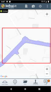
Long press the model until this dialog pops up.
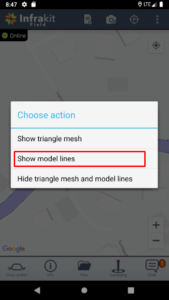
Select “show model lines” option and then click whichever line you want to start measuring your distance to. You will see the line’s information and blue “select” button. Press it!
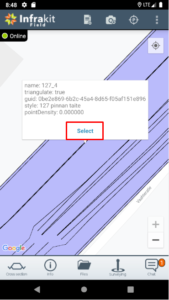
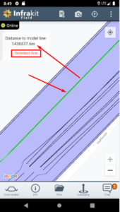
Now you can see that the selected line has turned green and in your top-right corner you can see your current distance to that line in meters. You can choose to measure distance to that line, select another one or unselect the current line.
Let us know if this feature and our ultimate goal for it is something that you’re interested or if you think we can change something or make it better in some way!

Book a Demo

Discover how Infrakit connects your entire infra project operations and drives value to every part of your business.
Brand spanking new Infrakit Knowledge Base

Brand spanking new Infrakit Knowledge Base


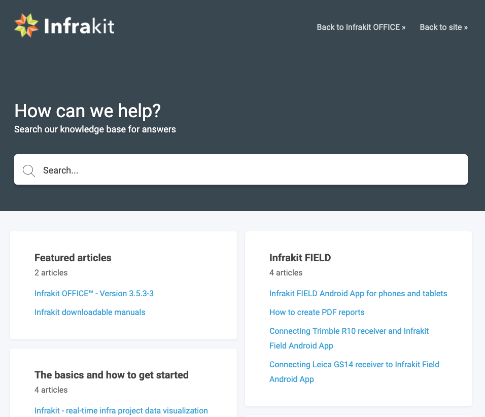
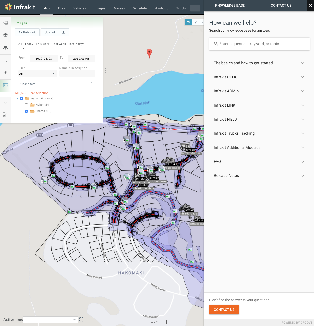
We’ve just published a Knowledge Base for Infrakit which covers all our solutions for infra-construction. You can read up on all the features and functionalities of Infrakit OFFICE™ and our Android and iOS apps. If you need to set up integrations to machine control systems there’s a whole section about Infrakit LINK™ and step-by-step instructions to get it done. Or maybe you just want to check out the latest release notes and additions to the FAQ.

You can also access the Knowledge Base directly in Infrakit by clicking the question mark on the bottom right corner.

Go check it out at https://support.infrakit.com/help

Book a Demo

Discover how Infrakit connects your entire infra project operations and drives value to every part of your business.
Learn more about vehicles on Infrakit OFFICE™

Learn more about vehicles on Infrakit OFFICE™


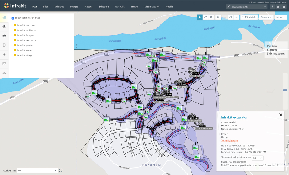
Once all the necessary design files have been added to Infrakit and can be viewed on the map the next logical step is to add all the vehicles operating at the project site. Once the vehicles have been registered they are listed on the map “Vehicles” tab and a color code indicates the status of the vehicle:

· Green: An active vehicle with active and working data connections to Infrakit. All assigned models have been synced between Infrakit and the machine.
· Red: Assigned models have not been synced between machine and Infrakit. Either sync is ongoing or waiting to happen or sync has failed, and data connections are down.
· Orange: Vehicle is activated for the project with latest models synced but it’s not online
· Grey: The vehicle is set to ‘on hold’ state or the vehicle is not activated for this project.

The separate “Vehicles” page gives an overview of the different vehicles registered on the project, but also gives access to more information about them:

The list of all vehicles registered to the project
The number of online vehicles
The overall efficiency of the vehicles on the project
The total amount of working hours registered by the vehicles.
Additional information about the vehicle (type, station location, last contact, efficiency, connection time and driver/additional information)
Button to “edit” the vehicle (only available for Admins)
Possibility to download locally on your computer the as-built points in format CSV, GT or XML for any given time range.
Efficiency: graph visualization of the efficiency of each vehicle compared to all.
Usage statistics: view for each vehicle, per week, their daily activity with information like exact time, starting/ending station and model used.
Manage rights: to define which models are accessible for each vehicle
Accuracy: detailed information about the as-built point loaded by this vehicle and its accuracy compared to the reference models.
So by having all the vehicles and work machines connected to Infrakit you get a real-time view of their activities on the work site. We support integration of machine control systems from vendors like Trimble, Leica, Topcon and Moba.

Book a Demo

Discover how Infrakit connects your entire infra project operations and drives value to every part of your business.

Thank you Bauma!

Thank you Bauma!


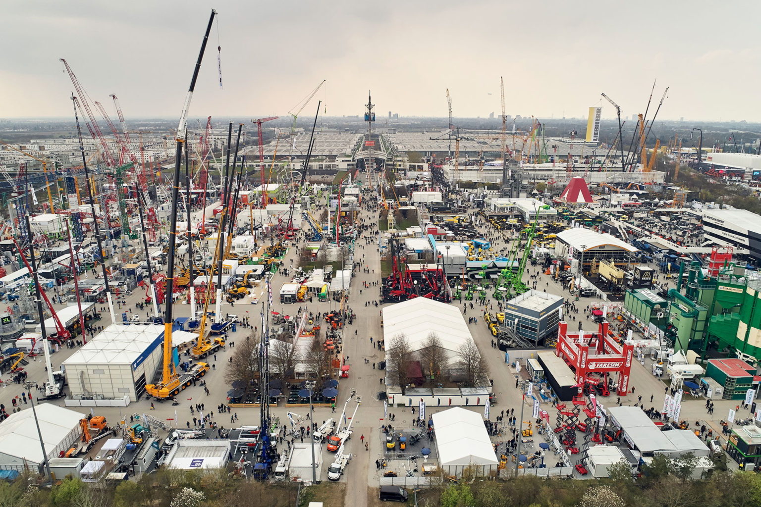
Bauma attracted more than 620 000 visitors this year! It is the best results in the exhibition’s 65-year history and the number of visitors rose by about 40,000 over the total produced during the previous event in 2016. Most of the visitors come from Germany, but more than 250,000 visitors came from countries outside Germany: Austria, Italy, Switzerland, France, the Netherlands, Russia, Sweden, the Czech Republic, Poland and Great Britain and from the overseas.

The clear focal point of this year’s Bauma was sustainable and digital solutions. Digitalization is a “megatrend” in the construction machinery industry, sensors and communication interfaces that collect and analyze data have become standard equipment.

Infrakit had our own stand first time in history this year at Bauma in the hall A2. Our International Business Developer Jan van den Brandt worked at our stand the full week and says it was a great success. During the seven days it was definitely the place to be. So let’s meet again in 2022!

The next Bauma will be held from April 4 to 10, 2022, at the Messe München Exhibition Center.

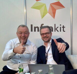
Jan van den Brandt and Pasi Joensuu happy after successful Bauma-week.

Book a Demo

Discover how Infrakit connects your entire infra project operations and drives value to every part of your business.
BIM’s advocates in Barcelona

BIM’s advocates in Barcelona

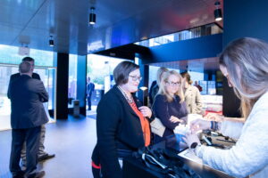
European BIM Summit – the annual international conference on Building Information Modeling (BIM), is held for the fifth time in Barcelona ( 11-12 of April). The conference has become the most advanced reference meeting on construction digitalization in Europe. The event started with a gala dinner at Roca Gallery that was organized by the Col·legi d’Aparelladors de Barcelona (CAATEEB), BIM Academy and buildingSMART.

Coordinator for buildingSmart in Finland Anna-Riitta Kallinen (in red) cheks in dinner at Roca Gallery in Barcelona (Photo: Marc Escola)


General Secretary Ferran Falcó opens the evening at Roca Gallery (Photo: Marc Escola)


President of CAATEEB Jordi Gosalves from European BIM Summit (Photo Marc Escola)


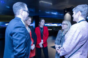
Pasi Joensuu, Linda Hakala, Annabella Polo – Advisor from Business Finland, Jenni Piela and Marja-Liisa Ketola (Photo:Marc Escola)

Massimo Rubino (in the middle) has an active role in advancing the use of BIM in Spain, especially in Catalonia. He is one of the organizers of the European BIM Summit and also works with BIMtour. BIMtour has held 15 sessions with more than 900 professionals in Spain from November to March in 2019. The sessions will show to the the professionals involved and the attending institutions how the BIM implementation will provide to their project and process higher productivity and efficiency. The purpose of the tour is to help people and companies to keep up with digitalization in construction industry. The gap between companies using the new technologies and companies using traditional methods is expanding. Read more about the European BIM Summit here, and BIMtour (in Spanish) here.

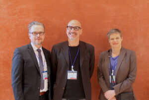
Pasi Joensuu from Infrakit, Massimo Rubino, Executive Director, BIM Academy and Marja-Liisa Ketola, Partner at Inseltrade

Marja-Liisa Ketola from Inseltrade has started to work with Infrakit in Spain. She has started with a market survey on trends and mobile connectivity focusing on motorways, railways, ports and airports. Ketola is actively looking for potential customers in Spain.

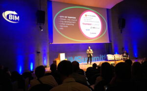
Petteri Palviainen, BIM Development Manager from Novatron got involved with BIM Summit Barcelona through InfraBIM Open event in Tampere. Here in Barcelona he explained to the international audience the Finnish way of using BIM (FINBIM) in infrastructure. As a case example Palviainen told about the tramway project in the city of Tampere. The new 23 km tramway is built by a tramway alliance which consist of the client i.e. Tampere city and the service providers, i.e. NCR Group Oy, YIT Construction Services and Pöyry Finland Oy. Infrakit is used in the project as a platform for managing machine control models and as-built information as well as digital handover material.

Petteri Palviainen talking about the Tampere tramway project and the Finnish way of BIM

An important game was shown at the gala dinner, only in Spain!

The founder and CEO of European BIM Summit, Ingasi Pérez Arnal promised: “Next year one third of the event will be dedicated for infrastructure”. We look forward to it!

Book a Demo

Discover how Infrakit connects your entire infra project operations and drives value to every part of your business.
It’s all about the map – get familiar with the Infrakit OFFICE™ map page

It’s all about the map – get familiar with the Infrakit OFFICE™ map page

Map page is at the core of Infrakit. In Infrakit OFFICE™ you can see your construction site in real-time with all the relevant information: 2D and 3D designs, as-built data, registered vehicles and equipment and uploaded photos and documents.

Infrakit uses open file formats. These are the current supported file formats and we are adding support for more as need arises.

Triangle mesh – File is a DXF or LandXML triangle mesh surface
IFC for structures (steel, concrete, etc.)
Pipe networks (LandXML)
Line model – File is a LandXML/Inframodel line model.
Map – DXF map file can contain lines, points, texts and other shapes
Alignment – File is a Landxml alignment.
Document – PDF, Excel, Word
Photos – JPG, PNG, GIF, TIFF.
Infrakit OFFICE™ does not require any local installation of software, it simply runs in the web browser. On the map page you have a selection of different tools like for example distance measure tool, area measure tool and cross section tool. You can quickly switch between different background maps from street map to satellite view.

If you want to read more about the map page check out this article in our knowledge base »

Book a Demo

Discover how Infrakit connects your entire infra project operations and drives value to every part of your business.