GUEST POST: Turning Point of Digital Infra-Construction
GUEST POST: Turning Point of Digital Infra-Construction

Turning Point of Digital Infrastructure Construction
(Written by Iiro Villman)

Summer, the high season of infra-construction business, is here and news about busy offer calculations and great amounts of projects offers can be heard from all over Finland. The most intense period of the whole year is on-going, but this time maybe even more actively than before. “If this is recession, hopefully it would last even longer”, a sentence heard from one contractor. This indicates that even winter wasn’t too bad for the infra-construction industry. Is the positive news stemming from the contractors, who have been keeping the offers low and – in this way – gotten themselves a lot more work with a smaller salary, or from the fact that they have some competitive advantage over other contractors?
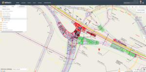
Digitization as an competetice edge: tangible benefits are seen in cost-efficiency

Technology for Everyone

There have been services for digital construction available for everybody’s use for some years already when trying to improve the competitiveness of the market, but still only few have utilized them in full scale. Finland’s major infrastructure contractors have been developing the technology and using the services for years, though. Their initiative and government-supported projects have developed technology to a much needed positive direction in the industry.

Now, however, it seems that the advantages of technology have been noticed among small and medium-sized operators as well. Machine control system sales are accelerating when, at the same time, applications and electrical tools are becoming more and more standards in the field. The benefits of the technology can be seen in the improved cost-effectiveness of projects and thus improving the competitiveness of companies. You see, in today’s contract contests, only few jobs are goldmines for the winning tender already from the beginning.

Total costs of the project are determined at the designing table, but during implementation phase the greatest costs arise from material purchasing and implementing the job itself. It is difficult to lower the material prices since manufacturing and raw materials’ costs are rising continuously. Instead, it can often be seen on worksites that machinery is on a standstill or tasks might have to be done twice due to construction errors or incomplete designs. New technologies provide new possibilities and solutions for lowering working costs and enhancing work efficiency for any project, but especially for projects that have set very low margins in the offer phase.

Professionally skilled staff and active foremen are the key players when talking about work efficiency. But what if the foremen don’t have the time needed to run the worksite with traditional methods? Machine control systems and data transfer applications – which are easy to use – help foremen, and make their tasks easier on-site. When utilized right, devices and applications pay themselves back quickly with work becoming much more efficient.
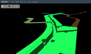
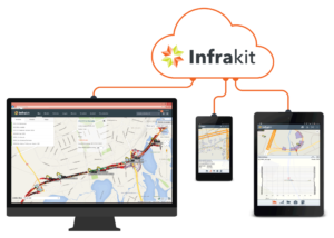
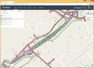
You can view 3D designs in real-time also on Infrakit

Real-time Quality Control

Nowadays project owners have a goal to implement projects with as high quality as possible with the lowest costs possible. Achieving and authenticating the given objective is based on mutual trust between project owners and contractors, even if the owner’s representative or consultant would visit the site often. Most of the end products in infra-construction remain hidden from the surface and it is not always possible to see from the finished structure whether the project was actually completed according to the design.

It’s not my intention to imply only the worst-case scenarios about contractors’ reliability or their ways of producing high quality projects, but to highlight all thepossibilities of improving the worksite’s real-time quality control processes brought by today’s techniques. Work on the construction site is progressing rapidly and getting the as-built data surveyed with the traditional methods to consultants and project owners can often take weeks. In the meantime, many phases have been completed following the possibly incorrect as-built data. Repairs done afterwards are always expensive and, in addition, violate the work that has been done correctly around the incorrect structure.
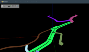
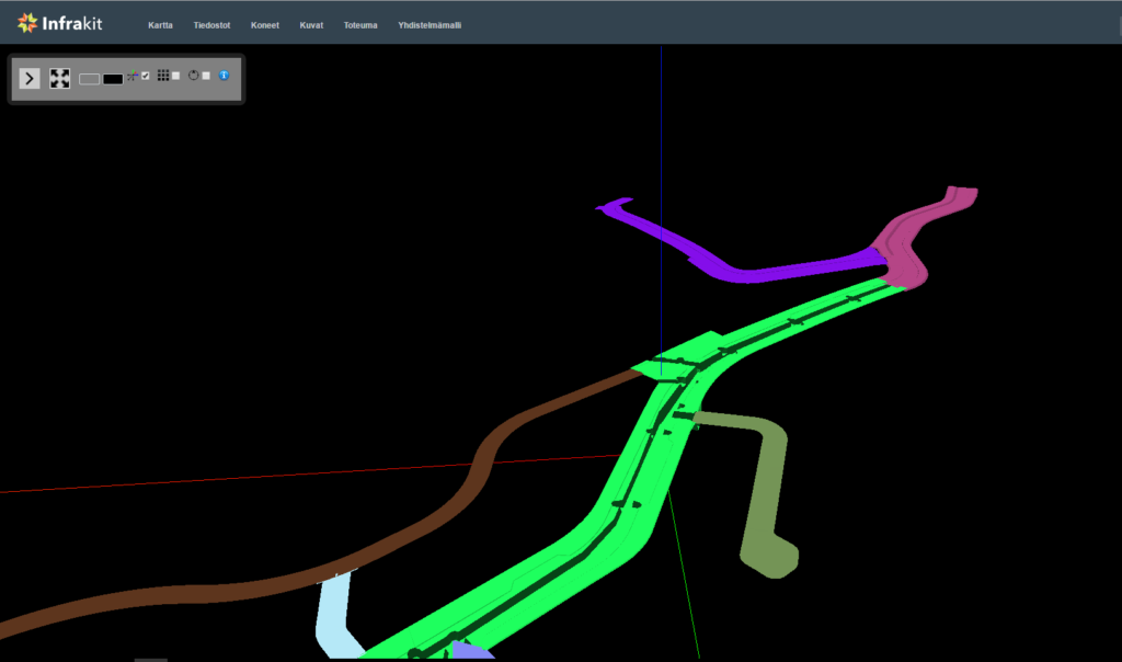
3D view of the project

Nowadays, project owners require more comprehensive documentation from the contractors just to ensure the usability of the structures. Contractors avoid expensive solutions that seemingly don’t directly affect the final result of their product. They try to come up with easier ways in order to fulfill the project owner’s requirements. For this reason, contractors have acknowledged digital applications, and benefits and possibilities provided by new technology. In order to achieve the desired transparency and comprehensive quality control, real-time applications have been taken in everyday use – at least in public sector’s construction projects. I sincerely wish that the private sector would follow their lead!

3D KOPPI logoThe issues mentioned above are based on stories told by different contractors and on my own experience from the private sector. I, myself, have worked as a site manager in earthmoving projects and seen the ways that tasks could be completed more efficiently with machine control systems and real-time data transfer and quality control. Luckily these kinds of solutions already
exist and new tools are created as we speak. Even the small contractors can get a competitive advantage by taking the newest technologies in use, and work the same way as the big companies.

Founders of 3D-KOPPI Sami Rautkoski (left) and Iiro Villman

The author, Iiro Villman, is the Project Manager of 3D-KOPPI Ltd., 3dkoppi.fi

Editor’s note: This is the 2nd post in our new Guest Post series where infra-construction experts and experienced doers tell about the transformation of infra-construction industry, digital leap and new winds of change in the industry. The posts are written by the authors themselves and the texts have not been edited (except a word-for-word translation into English).

Book a Demo

Discover how Infrakit connects your entire infra project operations and drives value to every part of your business.
Infrakit Truck App Now Available!

Infrakit Truck App Now Available!

The Truck App is at Work!

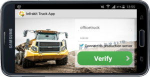
Truck App login

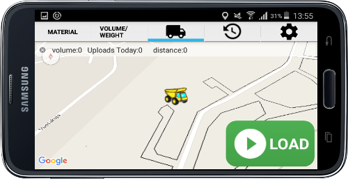
Infrakit has a very useful new product called the Truck Tracking App. The app is used for tracking of trucks and their loads and taking the paperwork out of the truck driver’s hands. The Truck App works on any Android device and, of course, in combination with the Infrakit server.

The App is now working in Finland and in the Netherlands in different projects and has proven to be very useful. Truck drivers like the fact that they have no paperwork anymore and project managers have all information available in real-time.

Super easy install: it takes only 1 minute

How does it work?

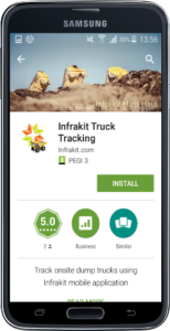
If you have a project in Infrakit you can assign trucks to the project. You also can define materials that need to be transported from A to B. All you need is an Android device: mobile or tablet. In preparation the truck driver only needs to install the app from Google Play Store here.

After a successful installation and logging in, he can choose the product and the volume — and he is ready to go. The only thing he has to do to use the app is press “LOAD” when he receives a load and press “UNLOAD” when he dumps it. All positions are automatically stored on the server from that moment and each individual load can be followed real-time. This is very convenient for the driver and for the administration as it saves a lot of time and provides accurate data from the field.

View from the App

It is even possible to do the recognition of the “LOAD” and “UNLOAD” sequences automatically. The project administrator can create so-called geo fences at the project map. So he can create one fence for “LOAD” area and one fence for “UNLOAD” area. As soon as the truck enters the LOAD area this will be recorded as a LOAD sequence and when he drives into the UNLOAD area the same will be done at the server. Very easy to use.

What to do with the information?

The information will be stored at the Infrakit server for each truck individually and can be viewed in different ways. It is possible to see 1) each individual drive, but also as 2) totals per truck or 3) totals per day and 4) per project.

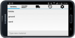
Example of material types

This gives a great overview with no additional effort at all and can be viewed by everyone that has access to the project. That can be the project leader or manager, but also the project owner if needed. A great new tool within Infrakit and new features will follow all the time!

Feel free to try the Truck App in combination with the Infrakit trial account here. And do so in combination with the great Infrakit App, too (downloadable from Google Play Store here). It can be used to take all your project information to the site with you and, for instance, use it for taking as-built measurements using Bluetooth connection via a GNSS rover. Read more about the Infrakit Android App from our blog: User Cases and how to use is as a Surveying Tool.

Book a Demo

Discover how Infrakit connects your entire infra project operations and drives value to every part of your business.
GUEST POST: Digitization and Transparency are Advantages also in Infrastructure Construction

GUEST POST: Digitization and Transparency are Advantages also in Infrastructure Construction

Digitization and Transparency as Assets
(Written by Teemu Tervahauta)

Improving productivity and competitiveness in general has lately been publicly discussed in Finland. Luckily, concrete actions have been taken in order to improve productivity in infra-construction industry. BIM has gained a significant role in larger infrastructure projects already.

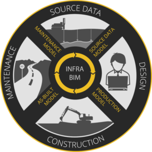
The basic idea of BIM is processing project data in an open, digital format instead of paper documentation so that the data can be utilized and shared more diversely. Fundamental in BIM utilization is lifecycle thinking, and seeing the big picture of the project instead of a single work phase at a time. Comprehensive modelling might increase designing costs but it can also save you a remarkable amount of money during the construction phase.

With BIM project information is transferred in an open, digital format from one phase to another

Transparency and Compatibility

What does transparency exactly mean and why should you strive for it? It is about how machinery, software and systems connect with one another. The question is justifiable since many worksites have various manufacturers in use, such as 3D machine control systems.

If the machine control system in use at your worksite requires designs in a manufacturer-dependent file format, the design data typically has to be converted into their own format with their own software. Format conversion is an additional work phase and, in addition, the metadata included in the original designs can be left out in the converted format. If the machine control system reads open formats instead, the processes will become more streamlined and irrelevant, extra activities will be eliminated.

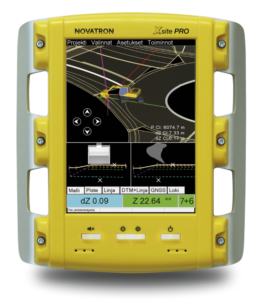
From the 3D machine control system’s screen excavator driver sees how much needs to be excavated at any given point. Novatron’s Xsite PRO system fully utilizes Inframodel3 models – including metadata.

Open Standard

In Finland, an open LandXML -based Inframodel3 -data transfer standard has been developed as a result of cooperation of several active parties. It is not just about file format but about diversely utilizing metadata of the modelled objects, such as codes and names.

Inframodel3 can be perceived as ‘intelligent’ data whereas the old data transfer formats, like dxf, represent ‘un-intelligent’ information. Inframodel3 loses its meaning if it is being used as a format among other formats. Full utilization of metadata is key to efficient use of Inframodel3.

On today’s infra-construction worksites digitization and transparency are therefore assets. Data modelling and 3D machine control represent ways of working that help infrastructure projects to be implemented more efficiently than before. Improving productivity does not result in increasing the hours worked, but in completing the work smarter than previously!

Infrakit also represents transparency. As a platform-independent worksite management service, it works with machine control systems by different manufacturers.

The author, Teemu Tervahauta, is the Business Development Manager of Novatron Ltd., Novatron.

Editor’s note: This post is first in our Guest Post series where infra-construction experts and experienced doers tell about the transformation of infra-construction industry, digital leap and new winds of change in the industry. The posts are written by the authors themselves and the texts have not been edited (except a word-for-word translation into English).

Book a Demo

Discover how Infrakit connects your entire infra project operations and drives value to every part of your business.
Infra-Construction in Year 2020

Infra-Construction in Year 2020

Paving the way for a digital revolution in infra-construction

Governments and other infrastructure owners around the world are paying the costs of inefficient and outdated construction methods. Hundreds of millions of euros are being wasted in antique work planning and building based on inaccurate paper designs. As each project is unique, the construction site is currently largely an ad-hoc operation, where work is being implemented according to the experience and vision of old school professionals and based on weekly meeting and communication by phone calls and paper.

From traditional..

What has always been, doesn’t have to stay that way for eternity

As infrastructure projects always include unexpected details due to unforeseen terrain qualities, the current but outdated methods cause a lot of waiting and wasted time. We see this as work machinery utilization rates as low as 20 to 30 % of scheduled working hours. Huge amounts of expensive heavy machinery hours, such as excavators and bulldozers, are being wasted and the project completion time is unnecessarily prolonged to double or even triple.

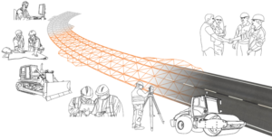
This is all going to change in a couple of years, and what we will see in year 2020 is more of a factory or process engineering style approach. Detailed pre-planning and scheduling, real-time tracking and project transparency will enable project managers to adapt to events on field and enable drastically shorter project completion times. On a high level this fundamental change in project management is called digital construction.

How does change happen?

..to new and improved.

There are several key steps that will be taken in the coming years. Design engineers and project owners need to embrace the real data needs of the construction work instead of thinking about traditional paper designs. This means using standards like the LandXML-based InfraBIM guidelines that are a government requirement in Finland (infrabim.fi).

Once the project has been modelled, detailed and accurate realization plans and schedule can be derived. This same model can also be used in work machinery which will semi-automatically implement the designed earthwork structures using high accuracy GPS/GNSS technology. Machinery will also automatically document the work phases they have implemented.

This all can be monitored online in real time and any deviations from designs or possible problems can be quickly dealt with. Mass hauls are preplanned and online systems track movement of all transport vehicles such as dump trucks. A projected completion time of any project task can be calculated online based on the current performance with assigned machinery. Additional resources can be dynamically added into critical path tasks to ensure they are completed according to planned schedule.

Infra-construction site where everyone and everything is connected

All equipment that is being installed, such as rail tracks, pipes and manholes, will have ID tags for tracking. Their current location and installation dates are known so their transportation and installation work can be accurately planned and monitored. The worksite has an online inventory and quota of all the needed parts and materials for the entirety of the project.

On-site personnel all have access to the site plans, schedule and current situation. They have a clear view of the tasks, where the project is today and what are the plans for today, this week, next month.

Infra-construction in a turning point

What the industry needs is open digital standards and true interoperability. More communication between design and construction phases of the project and integrations between different software and hardware systems. In the end, it’s all about collecting, sharing and distributing data.

The year 2020 is basically just around the corner and digital infra-construction is already here to stay.

Are you content with the traditional methods or ready to join the revolution?

Book a Demo

Discover how Infrakit connects your entire infra project operations and drives value to every part of your business.
Business Opportunities for Land Surveying Companies

Business Opportunities for Land Surveying Companies

Infrakit enables new business possibilities for land surveying companies

With Infrakit, it’s possible for land surveying companies to serve their construction company customers in a brand new, deep and exciting way. Using Infrakit land surveyors have a possibility to provide site foremen and managers an unprecedented real-time view into the progress and quality of their site.

Design and surveying information can be made available any time, with the use of internet browser or an Android field tablet computer. Tablet computers or mobile phones can be distributed to excavator and dump truck drivers enabling them to become part of the real-time site information flow.

Infrakit is looking for partners in land surveying companies to bring the digital revolution to work sites around the world!

GNSS surveying equipment (used by land surveyors, foremen and supervisors) and 3D machine control equipment fitted on work machinery can also be directly integrated with Infrakit to provide real-time data sync over the internet.

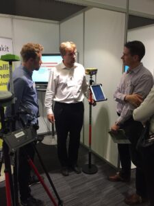
Toni shows Infrakit’s compatibility with GNSS devices

This means that any GNSS device on the field can be used to make measurements using designs and other data from Infrakit, removing the need for a pre-measuring data-prep work phase.

As land surveyors are experts in handling digital data, we see that their role will further increase in the coming years as new mobile tools such as tablets are adopted on the field.

Read more about the integration between GNSS equipment and Infrakit Android App here.

If you want to become a part of the Infrakit family, please contact us here or directly email our CEO Teemu Kivimäki teemu.kivimaki@infrakit.com.

Published originally: 30th of Sep, 2015.

Book a Demo

Discover how Infrakit connects your entire infra project operations and drives value to every part of your business.