InfraTech Germany Exhibition for Infrastructure

InfraTech Germany Exhibition for Infrastructure

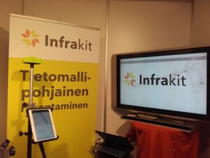
Next week we are participating in the InfraTech 2016 Exhibition in Essen, Germany (on 13-15 January). It covers the entire scope of infrastructure and focuses on road construction, water infrastructure, organisation of public areas, traffic and mobility.

Visitors to the exhibition are primarily German individuals who make the decisions on investments in infrastructure. Participants are mostly contractors, consulting and engineering firms, infrastructure wholesalers, suppliers, knowledge and training institutes.

We are looking forward to establish new contacts among German decision-makers, constructors and other participants. It is also interesting to see how far digital construction is on German construction sites in general.

See more information here. Pre-register as visitor and come talk to us at booth 11-305L.

See you there!

Book a Demo

Discover how Infrakit connects your entire infra project operations and drives value to every part of your business.

Infrakit and Leica iCON Telematics integrated

Infrakit and Leica iCON Telematics integrated

Infrakit and Leica Geosystems integration

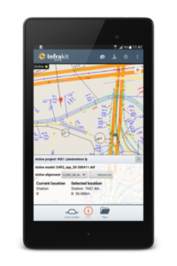
Infrakit and Leica Geosystems (Scanlaser) announce a historic cooperation to connect iCON 3D machine control systems and other iCON Telematics-compatible equipment to the Infrakit open site management platform. This means that construction companies can now manage their machine control data on one brand-independent platform, unifying site data processes and simplifying data synchronization with site work machinery. The final beta testing is ongoing. The integration will be available in Finland soon.

Infrakit App

Infrakit currently has direct real-time integration with the following machine control brands:
Leica Geosystems
Novatron
DigPilot
Prolec

In addition, Infrakit currently integrates the following machine control brands by means of file transfer:
Trimble
Topcon
Carlson Software

Book a Demo

Discover how Infrakit connects your entire infra project operations and drives value to every part of your business.
GIS Expo 2015

GIS Expo 2015

We participated in the GIS Expo (Helsinki, Finland) on November 3rd and 4th, where we launched the integration of Infrakit Android App with GNSS devices. This attracted visitors’ attention due to the new working opportunities it provides for them. At our stand we presented Topcon, Leica, Javad and CHC GNSS devices and we also tested compatibility with Topcon Hiper V receiver that makes RTK corrections connected via radio or Internet.

We also took part in the expo seminar by giving a presentation on how Infrakit digitizes construction sites. A small but active group of participants from infrastructure construction industry came to listen to it and they were very interested to hear more.

General feedback from the expo:

Site managers like the fact that with Infrakit they gain an easy access to centimetre-accurate data and they can do measurements and documentation more easily. Smaller companies were excited about our surveying package (Infrakit App + GNSS device) that would allow them to do land surveying themselves without the need to hire external surveying staff.

Project owners liked that photographs, comments and other documentation can be added straight to the map view on Infrakit. They were also impressed by the transparency Infrakit brings in terms of real-time project tracking.

Toni presents the Infrakit compatibility with GNSS devices

“Room for innovativeness and digitization”

It was great to see new technologies presented by GIS Expo participants such as virtual reality, airdrones, map-based analytics and many more. The CEO of RAKLI also talks about this in his blog: “My interest in new technologies and products is both personal and professional; the new RAKLI strategy emphasizes innovativeness and digitization”. At Infrakit we are glad that such thinking and desire for innovation spreads in our industry. We would be happy to collaborate with other companies to promote this spirit.

Have a great week everyone!

Always share up-to-date data on all mobile and desktop devices.

Book a Demo

Discover how Infrakit connects your entire infra project operations and drives value to every part of your business.
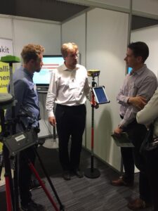
Infrakit Android App in Use on Infra-Construction Sites

Infrakit Android App in Use on Infra-Construction Sites

Infrakit App and GNSS devices

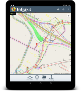
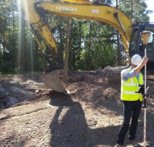
Infrakit App works with most GNSS devices which makes it a useful tool for on-site tasks that require accurate positioning such as land surveying and measuring as-builts. You can start surveying without preparation and the results are shown on Infrakit in real time. Measuring is made easy with Infrakit’s map-view.

The App is fully-integrated, for example, with following GNSS devices: Topcon GR3, Javad Triumph-2/Triumph-1, Trimble R10 and newest Leica GS14 and CHC receivers. It is possible to connect any GNSS device supporting Bluetooth. For more information contact our sales: toni.louhisola@infrakit.com, +358 40 562 5444.

Infrakit App new user interface

With the App you can work with Infrakit in offline mode

Use 2D/3D materials uploaded to Infrakit and work on your chosen coordinates. Utilize Infrakit also for preparing other documentation and photographs from the site.

Read below what Destia’s Chief Surveyor says about using Infrakit App:

Infrakit App + GNSS

“For site managers’ use there is big potential. Let’s look at small projects where land surveyor is not always available: with Infrakit App + GNSS device you can measure even protective tubes or excavations and make transport arrangements when you know the precise locations of cross-sections. You can make small mass calculations more accurately, bigger mass calculations always require more measuring work. I use Infrakit App also for surface area calculations and blastings – there are many ways to use it.” -Tero Maijala, Chief Surveyor, Destia

Book a Demo

Discover how Infrakit connects your entire infra project operations and drives value to every part of your business.

News: Infrakit projects in the Netherlands

News: Infrakit projects in the Netherlands

Infrakit reaches its first project in the international markets

Combination Jansma/Roelofs/VanSpijker has been awarded the contract for De Centrale As Noord 1. In this project they will be using Infrakit Construction Collaboration Cloud.

Project owner is Province of Fryslân and the contract manager of this project will use Infrakit as well. Infrakit will be used from the design phase until construction and as-builts. In this project the engineering and project management will be done by Roelofs and the earthwork will be done by Jansma. Van Spijker will do the concrete elements.

One platform – Infrakit – enables the use of BIM throughout the project and will increase efficiency for all participants – and vastly decrease errors and costs.

We congratulate the allience of these three great companies of this nice order and wish you all a successful execution of this project!

Book a Demo

Discover how Infrakit connects your entire infra project operations and drives value to every part of your business.