The New Infrakit version brings more CDE features and enhanced 3D experience!
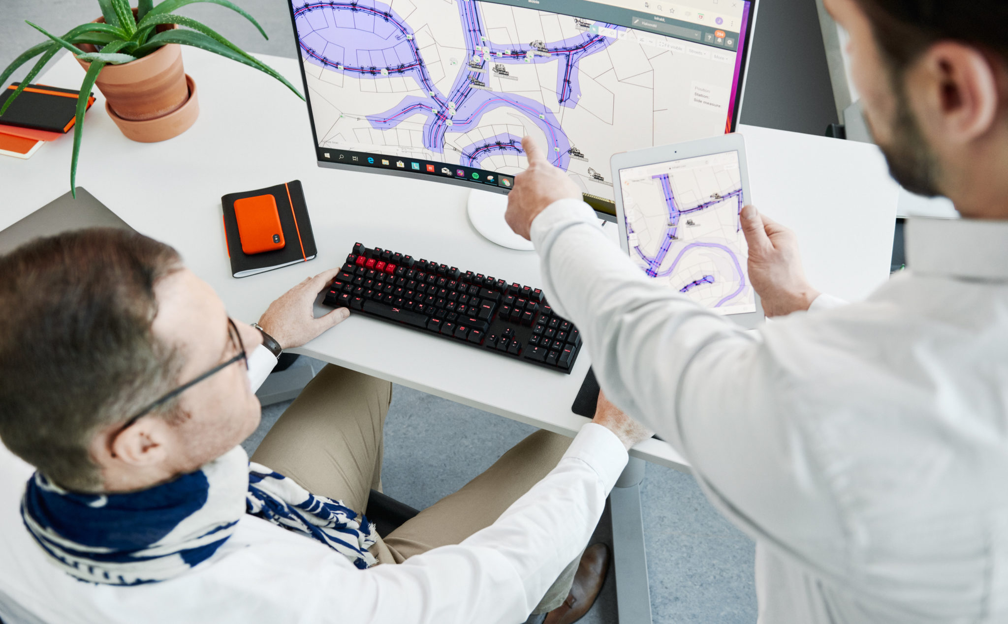
The New Infrakit version brings more CDE features and an enhanced 3D experience! 

Release blog posts may not be the most popular ones we’ve got, but we could argue that they are high value providing hidden gems for those that do open these. Seems that you are one of those pioneers, and forerunners of the industry, so congratulate yourself on being on the tip of the iceberg, by educating yourself to be the ”digitalization champion” who rides the tide!  

For release 3.8.2 of Infrakit OFFICE, we focused on making features that help manage all project documents in Infrakit, not only the ones you would visualize on the map. Together with that, we have enhanced the 3D BIM viewing. In other words, these features enable you to work faster,  collaborate better, and be the star of your project! 


Optimize your data management with new CDE features

It’s no big secret that data management is the key to successful projects. This time we focused to enhance our CDE features by adding you an opportunity to set and manage properties for your files. 

Was it either file categories of Design Disciplines, Model maturities, or phases of the project, property management saves you a ton of time. Add your custom property as a number, text value, or in a list of options. 

Check how to use it from the video below! 


Simplify your mountain of information 

Infraprojects tend to have quite an overwhelming amount of files… Thus, filtering and sorting out the ones you don’t need in the UI brings simplicity.  

To enable this step by step, we developed another CDE feature, which enables you to make any file or folder dispappear from the visualization apps.  As an example, you can use the Infrakit as single source of truth platform for all the project files. Store and manage the revisioning of the native drawings that are not meant for map projection. With this feature those files are not bugging the users of the Map page. 

We also introduced handy left-click menus on web UI, make sure you don’t miss that one! 

The video below once again will show you a quick and easy way of using this feature! 

Become a superior collaborator with enhanced 3D’s and point clouds 


Wouldn’t you want to be the champion, who makes everyone in project-wide collaboration feel happy and safe? Yea, that is precisely why (once again), we used a ton of focus on making Infrakit help you to be the champion. 

Infrakit’s high-power 3D engine can smoothly render your map and 3D data in one view on any modern hardware (yeah, that’s including phones and tablets). The 3D view now also enables you to see the station numbers of alignments, enabling finding the right spot on the project even handier. On top of these, the new version enables you to select multiple point clouds to be visualized at the same time!  

These features not only make the designs and visualizations of the site look good but you as well! 


Check the more in-depth list of new features and improvements of this version from our Knowledge Base

Jere Syrjälä
March 13th, 2023

Book a Demo

Discover how Infrakit connects your entire infra project operations and drives value to every part of your business.

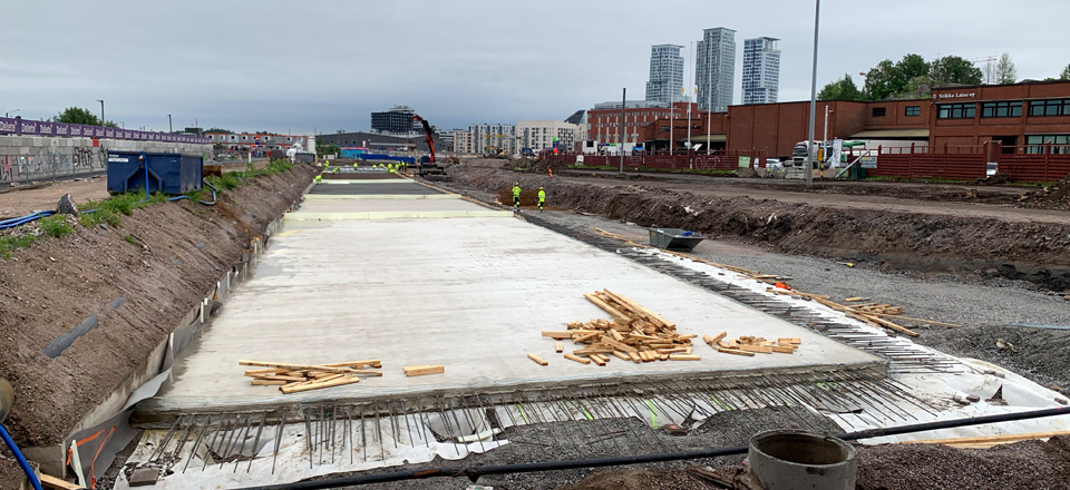
Climate Fund – €6 million capital loan to Infrakit for the development and commercialisation of sustainability functionalities for boosting emissions reductions in infrastructure building

Climate Fund – €6 million capital loan to Infrakit for the development and commercialisation of sustainability functionalities for boosting emissions reductions in infrastructure building

The Finnish Climate Fund has decided on a capital loan of up to 6 million euros to Infrakit Group Oy for the development of sustainability functionalities in their data management service, as well as for boosting the software’s international deployment. Improving the efficiency of transport and the utilisation of machines and materials can reduce the emissions of infrastructure construction sites by an estimated 5%.

Infrastructure building refers to the construction of, for example, transport routes, logistics centres, energy infrastructure or industrial structures. The sector’s annual emissions in Finland are approximately 1.4 Mt CO2eq, of which roughly 55% is generated by the fuel consumption of machinery and vehicles.

Infrakit offers data management services for infrastructure projects, particularly for reducing the duration and costs of construction. ”Until now, we have been able to promise our customers savings of approximately 20% in overall infrastructure building costs by improving the efficiency of operations with our service. Many projects have also been completed ahead of schedule, like the 70-million-euro project on Highway 3. Now we want to bring the same benefits to sustainability”, says Infrakit’s CEO, Teemu Kivimäki.

Infrakit’s sustainability function will offer more precise information and tools for boosting emissions reductions to construction companies and infrastructure managers in Finland and abroad. The service lets its users leverage climate and environmental data as well as measure and anticipate the emissions generated by their operations.

”Infrakit’s comprehensive data management service is one way of boosting the sustainability perspective in the construction sector. For example, cities and municipalities could use the service to set requirements and goals for builders regarding their emissions. Our investment accelerates the growth of an emissions-reducing solution and enables the development of new sustainability functionalities”, says CEO Paula Laine of the Climate Fund, shedding light on the reasons behind the investment decision.

Infrakit’s solution

Infrakit Group Oy is a company established in 2010 that offers cloud-based data management services to infrastructure construction sites. Infrakit’s solution has already been used in over 3,000 Finnish and international projects worth more than 30 billion euros in total.

The emissions reductions achieved by Infrakit are indirect: its technology enables the recognition of emissions but the ultimate emissions reductions depend on the corrective action taken by the company’s customers instead of directly from the technology or product of the company being financed. Infrakit’s data-based management features offer tools for determining the customer’s carbon footprint, monitoring actual emissions and optimising emissions during the project’s implementation. By using this data, Infrakit’s customers are able to decrease their emissions.

The project’s estimated emissions reduction potential is based on the improvement in infrastructure building efficiency achieved by the data model platform provided by the company, which can for example reduce the fuel consumption of machinery at the construction site. The magnitude of the emissions reductions achieved in a single infrastructure building project is approximately 0.6 kt CO2eq. If Infrakit’s business plan succeeds, its ten-year cumulative emissions-reduction potential is approximately 3 Mt CO2eq. The emissions-reduction benefits brought by the new sustainability functionality currently under development would be realised in addition to this estimate, but the assessment of their magnitude involves uncertainties, so they have not been included in the emissions-reduction estimate above. The project targets markets both in Finland and abroad but Infrakit believes that most of its growth will be achieved abroad.

The total investments in the company’s growth and development plan in the next few years are estimated at €12.6 million, consisting of the Climate Fund’s capital loan, €5 million in equity funding from one of the company’s current shareholders and grants from Business Finland and the Centre for Economic Development, Transport and the Environment.

The Climate Fund’s capital loan of up to €6 million has a convertibles option and will be allocated to the development of an emissions-reducing functionality and the acceleration of the software’s international deployment. The interest on the Climate Fund’s capital loan is priced at the market rate and the capital loan also includes a conversion right.

For additional information, please contact:
Saara Mattero, Director, Communications and Sustainability, tel. +358 400 114 777 saara.mattero@ilmastorahasto.fi

Anssi Johansson, VP of Marketing, tel. +358 40 592 9933, anssi.johansson@infrakit.com

The Finnish Climate Fund is a Finnish state-owned special-assignment company. Its operations focus on combating climate change, boosting low-carbon industry and promoting digitalisation. The Climate Fund invests in large-scale projects in which the fund’s investment is crucial to enable the project’s realisation in the first place, on a larger scale or earlier than it would with funding from elsewhere.

Infrakit – Your digital transformation partner. Infrakit is an industry-disrupting digital platform to increase infrastructure construction productivity. We are driven by the goal of a sustainable infra industry – while offering 20% savings in total project costs. Our customers include the most advanced construction companies and infrastructure owners in the world. We have been helping our customers to digitalize their infra projects since 2010 – over 30 billion euros of infra assets has been built with Infrakit in more than 3000 projects in 13 countries.

Anssi Johansson
February 8, 2023


Book a Demo

Discover how Infrakit connects your entire infra project operations and drives value to every part of your business.
Projet Kalasatama-Pasila – une avancée majeure vers un site de construction à zéro émission

Projet Kalasatama-Pasila – une avancée majeure vers un site de construction à zéro émission

Se fixer des objectifs d’émission au niveau de l’entreprise devient assez courant dans le secteur de l’infrastructure. Toutefois, la prise de mesures concrètes et significatives permettant d’atteindre ces objectifs s’est fait attendre.

Les objectifs de neutralité carbone de haut niveau ne peuvent se concrétiser que lorsque les moyens de réduire les émissions sont élaborés dans le cadre de projets réels.

Une avancée majeure vers la neutralité carbone

Destia, le principal maître d’œuvre du projet d’alliance Kalasatama-Pasila à Helsinki, a mis ces résolutions en pratique, en collaboration avec l’équipe chargée de la durabilité du projet.

En coopération avec d’autres partenaires du projet, Destia pilote actuellement la surveillance des émissions basée sur les données de production, ce qui permettra non seulement d’assurer une vérification plus exacte et de meilleure qualité des émissions, mais aussi de suivre un processus plus léger pour générer les données de surveillance.

De l’estimation à la vérification des émissions

À l’avenir, les émissions pourront être optimisées en les vérifiant. Cette optimisation nécessite des mesures, et permettra à terme d’atteindre les objectifs de neutralité carbone fixés pour la construction d’infrastructures.

Nous nous sommes davantage concentrés sur le développement de solutions permettant d’atteindre les objectifs de neutralité carbone. Une part de cet engagement est d’élaborer des systèmes de surveillance des émissions basés sur les données de production.

En savoir plus

Jere Syrjälä
January 31, 2023


Book a Demo

Discover how Infrakit connects your entire infra project operations and drives value to every part of your business.

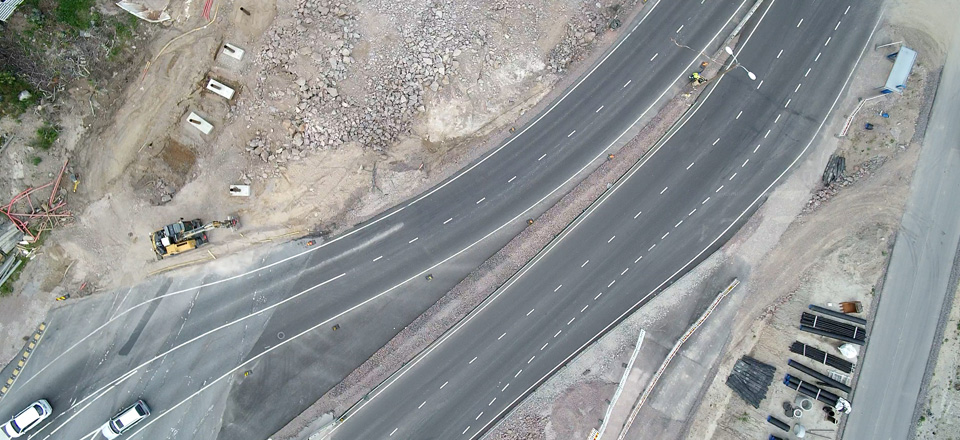
Le projet d’aménagement de la Route nationale 3, d’un montant de 70 millions d’euros, s’est terminé avec un an d’avance sur le calendrier prévu

Le projet d’aménagement de la Route nationale 3, d’un montant de 70 millions d’euros, s’est terminé avec un an d’avance sur le calendrier prévu 

Les travaux de construction de la Route nationale 3 finlandaise ont commencé au cours de l’été 2020 et se terminent en novembre 2022, soit avec un an d’avance sur le calendrier prévu. Dans le plan initial, la mise en service devait avoir lieu à l’automne 2023.

La route nationale, qui traverse Hämeenkyrö, a été améliorée par la construction d’un tronçon de 10 kilomètres à quatre voies. La route comporte 3 passages à niveau et 11 ponts. Infrakit a participé à la mise en œuvre de l’ensemble du projet. Depuis la phase de planification jusqu’à la supervision des travaux et l’assurance qualité.

Le volume de trafic journalier moyen (TJM) actuel sur les sections de la nationale 3 le long du lien routier se situe entre 2 500 et 16 900 véhicules par jour. D’ici à 2040, on estime que le trafic journalier augmentera jusqu’à atteindre 2 800 à 24 700 véhicules par jour. La part des poids lourds dans le trafic total varie entre 6 % et 16 % (Vayla.fi)

Ce projet a été établi par l’Agence finlandaise des transports et confié à Destia. Le nouveau tronçon routier va réduire le temps de trajet entre Helsinki et Vaasa et améliorer la fluidité du trafic et la sécurité sur la route nationale.

Un grand projet d’infrastructure nécessite une planification détaillée

Une bonne planification est essentielle pour éviter les retards. Infrakit a été impliqué dans le projet depuis le début et a collecté les données de conception.
Dans le cadre de la numérisation du secteur, le logiciel d’Infrakit facilite le travail sur plusieurs phases. Ce logiciel rationalise le flux d’information depuis la phase de conception jusqu’au rapport, en passant par la mise en œuvre.

Le chantier a été réalisé suivant un modèle de prestataire traditionnel, mais les solutions de conception des routes ont d’abord été pensées et développées ensemble. La plateforme numérique a permis de rationaliser le processus de conception.

Les cartes et la modélisation en 3D mises à la disposition de tous les planificateurs ont démontré l’avancement des plans.

En termes de surveillance, Infrakit peut être utilisé pour contrôler l’exécution et l’exactitude des données. Cela permet de surveiller l’avancement des travaux en temps quasi réel. En outre, des données exactes peuvent être comparées aux surfaces et aux niveaux conçus en fonction des tolérances structurelles.

La numérisation et la rationalisation du flux d’information influencent la prise et le suivi des décisions. Cela contribue grandement à respecter les délais.

Une communication fluide sur site réduit les retards

Pour respecter le calendrier, il est essentiel de répondre aux défis et aux changements et de prendre des décisions au cours de l’avancement du projet. D’énormes quantités de données sont générées sur site pendant la construction, et l’organisation et le partage de ces données accélèrent considérablement les travaux.

Les données collectées permettent de plus simplement dresser un tableau de la situation et suivre les travaux. La prise de décision est également plus facile lorsqu’elle s’appuie sur des données contextuelles et des faits suffisants.

La plateforme Infrakit permet aux utilisateurs de télécharger des orthophotos en tant qu’images cartographiques, sur lesquelles les plans peuvent être visualisés. Il est ainsi facile de voir que les routes, les lignes et les structures ont été construites aux endroits prévus sur le site. Cela permet de suivre la mise en œuvre et l’avancement des travaux tels que les chaussées, les marquages routiers et les travaux de finition et de revêtement.

Réformes du développement durable dans le secteur de la construction d’infrastructures

La durabilité est également évidente dans le développement des travaux routiers. Dans le projet d’Hämeenkyrö, une grande importance a été accordée à la réutilisation des matériaux de construction, ce que l’Agence finlandaise des transports soutient dans ses directives renouvelées en matière de durabilité. Infrakit s’inscrit dans cette tendance. L’amélioration du flux d’information et l’utilisation plus efficace des ressources permettront de réaliser des économies d’énergie et de matériaux usagés.

Les coûts peuvent être réduits en utilisant des matériaux recyclés. Cela permet également d’économiser les ressources naturelles et de recycler les déchets au lieu de les mettre simplement à la décharge. À Hämeenkyrö, des matériaux durables provenant de la région ont été utilisés pour les murs antibruit et les matériaux de surface.

« C’est vraiment gratifiant de voir notre client réussir son projet en utilisant les derniers procédés numériques. Bien entendu, un projet mis en œuvre efficacement a également une empreinte carbone nettement inférieure », a déclaré Teemu Kivimäki, le PDG d’Infrakit.

Infrakit favorise l’écocompatibilité et la durabilité des infrastructures en optimisant les ressources. Avec l’augmentation des prix des matières premières, l’efficacité des ressources permet de réaliser d’importantes économies. En savoir plus sur la soutenabilité d’Infrakit

Anssi Johansson
December 19, 2022


Book a Demo

Discover how Infrakit connects your entire infra project operations and drives value to every part of your business.

Infrakit 3.8.1. is out, and here is what you should know about it!

Infrakit 3.8.1. is out, and here is what you should know about it! 

We are delighted to have the Infrakit version 3.8.1. up and running. There are some great new features for you to have a seamless experience in your daily work using Infrakit. We gathered the three most important highlights for you to quickly grasp on, what the new version holds and how it will make your life at the site better! 

Brand spanking new IFC models on map  

It is unfortunately true, that many times 3D rendering is waay too complex to manage, especially on mobile over a bad network. Therefore, we are super happy to bring the new IFC Outline generation for you, which enhances the mobile experience! 2D rendering is important especially on mobile, to avoid complexity and long waiting times. With the new version and reparsing, you will have a collaboration model in 2D, earthworks, and structures in one view. Easier and faster than ever, right?


Supercharged communication with new annotation tools 

Communication with the new annotation tools for Saved views is made easier than ever. Internally they help you for example sharing agendas in site meetings, showcasing risks and traffic plans, or requesting information from designers, externally you can share traffic arrangement information. 


The power of Saved views is greater than ever, and that power is in the palms of your hands! 

A new era of Security – SSO Login  

Managing your project information in Infrakit is now almost as safe as keeping your gold in Fort Knox… Now it is time for you to call your organization’s IT gurus and tell them to connect your organization’s Azure AD to Infrakit!  

Why? You know better than anyone, that it is everyday life on a site where subcontractors are coming and going, and project staff changes. With Azure AD connection, data security is ensured with an up-to-date user register that automatically syncs up with your organization’s register. 

See in-depth list of new features and improvements of version 3.8.1. here 

Jere Syrjälä
December 5, 2022

Book a Demo

Discover how Infrakit connects your entire infra project operations and drives value to every part of your business.

Welcome the new Infrakit version 3.8.0, where construction collaboration has been taken into a whole new level!

Welcome the Infrakit version 3.8.0, where your construction collaboration is brought to a whole new level!

We are delighted to release the Infrakit version 3.8.0 to general availability! This version brings many long-awaited features, such as turbo-charged 3D visualization, mobile access to saved views, and wider support for Kilometer posts of Railway stationing. And these are only to name a few of the absolute highlights of the release. 

Fast loading and rendering of 3D visuals 

Infrakit has now an intelligent way of optimizing the visualization of 3D models. Firstly, the time for model files to open is now drastically quicker. Secondly, all content opened renders about 10x faster! This improves your experience of 3D visualization on large job sites. 

Please note the new Shade button that highlights the edges of the structures also when they are under other models.  

Psst… look at those even more awesome point clouds! 

Mobile Saved Views 

Collaboration from the field can now be done at a whole new level. With mobile access to saved views, you will be able to select a subset view of the site and share it with all the users you want to collaborate with on the field. Were you either inside your office or on the field with only a mobile phone in your pocket, saved views will save a ton of time and effort from you by showing only the necessary information that another user wanted to share with you.  

Railway kilometer posts 

If you are using Infrakit in a railroad construction project, this is an absolute must-have for you guys, and we are happy to have it ready for you. Now that all the kilometer posts, hence, stations are displayed in Infrakit, locating documents and all the other information is a peace-of-cake. Further improvements to this feature are upcoming in later releases! 

Check the more in-depth list of new features and improvements of this version from:  https://support.infrakit.com/help/infrakit-office-version-3-8-0 

Jere Syrjälä
November 18, 2022

Book a Demo

Discover how Infrakit connects your entire infra project operations and drives value to every part of your business.