BIM’s advocates in Barcelona

BIM’s advocates in Barcelona

European BIM Summit – the annual international conference on Building Information Modeling (BIM), is held for the fifth time in Barcelona ( 11-12 of April). The conference has become the most advanced reference meeting on construction digitalization in Europe. The event started with a gala dinner at Roca Gallery that was organized by the Col·legi d’Aparelladors de Barcelona (CAATEEB), BIM Academy and buildingSMART.
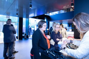
Coordinator for buildingSmart in Finland Anna-Riitta Kallinen (in red) cheks in dinner at Roca Gallery in Barcelona (Photo: Marc Escola)

 

General Secretary Ferran Falcó opens the evening at Roca Gallery (Photo: Marc Escola)

 

President of CAATEEB Jordi Gosalves from European BIM Summit (Photo Marc Escola)
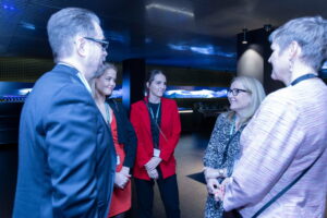
 

Pasi Joensuu, Linda Hakala, Annabella Polo – Advisor from Business Finland, Jenni Piela and Marja-Liisa Ketola (Photo:Marc Escola)

Massimo Rubino (in the middle) has an active role in advancing the use of BIM in Spain, especially in Catalonia. He is one of the organizers of the European BIM Summit and also works with BIMtour. BIMtour has held 15 sessions with more than 900 professionals in Spain from November to March in 2019. The sessions will show to the the professionals involved and the attending institutions how the BIM implementation will provide to their project and process higher productivity and efficiency. The purpose of the tour is to help people and companies to keep up with digitalization in construction industry. The gap between companies using the new technologies and companies using traditional methods is expanding. Read more about the European BIM Summit here, and BIMtour (in Spanish) here.
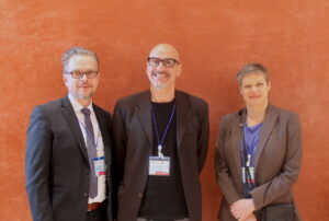
Pasi Joensuu from Infrakit, Massimo Rubino, Executive Director, BIM Academy and Marja-Liisa Ketola, Partner at Inseltrade

Marja-Liisa Ketola from Inseltrade has started to work with Infrakit in Spain. She has started with a market survey on trends and mobile connectivity focusing on motorways, railways, ports and airports. Ketola is actively looking for potential customers in Spain.

Petteri Palviainen, BIM Development Manager from Novatron got involved with BIM Summit Barcelona through InfraBIM Open event in Tampere. Here in Barcelona he explained to the international audience the Finnish way of using BIM (FINBIM) in infrastructure. As a case example Palviainen told about the tramway project in the city of Tampere. The new 23 km tramway is built by a tramway alliance which consist of the client i.e. Tampere city and the service providers, i.e. NCR Group Oy, YIT Construction Services and Pöyry Finland Oy. Infrakit is used in the project as a platform for managing machine control models and as-built information as well as digital handover material.
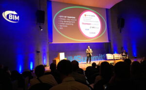
Petteri Palviainen talking about the Tampere tramway project and the Finnish way of BIM
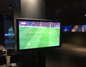
An important game was shown at the gala dinner, only in Spain!

The founder and CEO of European BIM Summit, Ingasi Pérez Arnal promised: “Next year one third of the event will be dedicated for infrastructure”. We look forward to it!

Book a Demo

Discover how Infrakit connects your entire infra project operations and drives value to every part of your business.
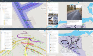
It’s all about the map – get familiar with the Infrakit OFFICE™ map page

It’s all about the map – get familiar with the Infrakit OFFICE™ map page

Map page is at the core of Infrakit. In Infrakit OFFICE™ you can see your construction site in real-time with all the relevant information: 2D and 3D designs, as-built data, registered vehicles and equipment and uploaded photos and documents.

Infrakit uses open file formats. These are the current supported file formats and we are adding support for more as need arises.

Triangle mesh – File is a DXF or LandXML triangle mesh surface
IFC for structures (steel, concrete, etc.)
Pipe networks (LandXML)
Line model – File is a LandXML/Inframodel line model.
Map – DXF map file can contain lines, points, texts and other shapes
Alignment – File is a Landxml alignment.
Document – PDF, Excel, Word
Photos – JPG, PNG, GIF, TIFF.
Infrakit OFFICE™ does not require any local installation of software, it simply runs in the web browser. On the map page you have a selection of different tools like for example distance measure tool, area measure tool and cross section tool. You can quickly switch between different background maps from street map to satellite view.

If you want to read more about the map page check out this article in our knowledge base »

Book a Demo

Discover how Infrakit connects your entire infra project operations and drives value to every part of your business.
Infrakit at BIM World Paris 2019!

Infrakit at BIM World Paris 2019!

You can find us at the booth Building Smart (G51) on April 2nd and 3rd, 2019.

If you are in Paris on April 1st and you want to know more about how BIM is used in Finland, you can join us at the Embassy of Finland to discover more. To read more click here.

Very often, public worksites lack information available realtime at the right time and in the right place. Infrakit offers companies and work sites the possibility of obtaining the necessary information at any time and in any place. When all the actors and equipment have all the necessary information in real time, unnecessary costs can be avoided and the projects completed according to the schedule.

Infrakit is an independent platform but works with partners such as Trimble, Leica, Topcon, Moba / Novatron and others! So you can manage all your information on a platform without changing your already existing tools. So, earthworks, topography, execution monitoring or digital DOE, Infrakit allows you to efficiently manage your public works sites!

Come and find us at booth G51!

Book a Demo

Discover how Infrakit connects your entire infra project operations and drives value to every part of your business.

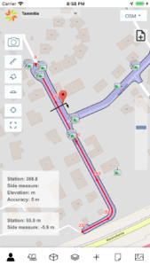
Infrakit FIELD™ app goes iOS and now available on Apple App Store

Infrakit FIELD™ app goes iOS and now available on Apple App Store

Our family of mobile apps has grown with a new member Infrakit FIELD™ Lite for iOS released this month. The latest version is the first stable release and includes all the web mobile functionality. The app works both on iPhone and iPad and will be updated frequently as all of our products. Already this year we have released a total of over 80 new features and improvements across our product line. For iOS we also have Infrakit Truck Tracking app which you can use to track the trucks and other vehicles on your project site.

Infrakit FIELD™ Lite on Apple App Store »

Infrakit Truck Tracking on Apple App Store »

Also if you are on Android don’t forget you can download the apps on Google Play store:

Infrakit FIELD™ on Google Play store »

Infrakit Truck Tracking on Google Play Store »

Book a Demo

Discover how Infrakit connects your entire infra project operations and drives value to every part of your business.

Faster, cheaper and higher-quality roadworks

Faster, cheaper and higher-quality roadworks

Digitalization is making strong advances in infrastructure construction. Pioneers can benefit from the ease of worksite monitoring it brings as well as time and cost savings.

Traditional infra construction has involved printing plans on paper and transporting them long distances around the worksite. This leads to inefficiency and errors. The increasing prevalence of mobile devices, improved communication connections and GPS control systems in work machinery now enable the adoption of digital models. Digital cloud services enable faster construction, more efficient use of resources and less errors and waiting at sites.

“With digital plans, everyone knows what they need to do and have access to the latest updated plans. At the core of it all is an information model where the designs are made as 3D models,” says Teemu Kivimäki, CEO of Infrakit.

In Finland, the digitalization of infra construction is at an advanced level, at least among certain players. Destia is currently the most digitalized company, even on a global scale. Digitalization has allowed the company to decrease project turnaround time by a third. The City of Espoo also uses a digital information model for a variety of purposes. However, Kivimäki considers it problematic that municipal decision-makers often seek solutions from abroad rather than turning to the world-class expertise found in Finland.

“The Infrakit cloud service is an independent and neutral platform that supports all devices. The use of Infrakit makes the project transparent, and processes can be systematically improved. The service provides instant visibility into what’s going on at the worksite and how efficiently. The cloud service can also be shared with others,” continues Kivimäki.

Infrakit operates through a map view that shows all the work machinery at the worksite, project-related plans, and how the work is progressing. The view is real-time. Kivimäki notes that, in the old way of working, plans and the actual as-built status were often only approximate. By using detailed 3D models, it can instantly be seen if there are deviations at the construction site. This makes for higher quality.

Work is more efficient when all machines are in operation at once

Road construction is always complex and involves a great many different elements. If one work phase lags behind, it has an exponential effect on the following phases. Using a digital model reduces complexity, as users have a clearer view of the whole and everyone has access to the same plans. Project speed is also increased when machinery can be operated more efficiently. Most of the work is done with machines, yet it is common at worksites for only one machine out of five to be in operation at any one time, while the others wait.

“Using Infrakit, four out of five work machines can be operational at once. The efficiency of the machines is increased by 30 to 40 percent on average,” says Kivimäki.

Road projects are usually tax-funded and cause disturbances to traffic. Hence, reducing project turnaround time and decreasing costs also benefits the local residents. Costs are further cut by reduced material consumption. When the work is done right the first time without needing to tear down previously built sections, less material is used.

“The cost savings brought by digitalization compared to previous working methods is about 20 percent. Of this, the use of Infrakit accounts for some 5–10 percent,” Kivimäki remarks.

Infrakit

– Founded in 2010 as a University of Oulu spin-off project.

– Undergoing strong growth, with doubled revenue in 2018.

– Subsidiaries in Sweden, Norway, Denmark and the Netherlands.

– Employs 25 people, about half of them in Finland.


“With digital plans, everyone knows what they need to do.”


Photo by Aleksi Palmqvist

Teemu Kivimäki hopes that municipal decision-makers would see the benefits of digitalization in infrastructure construction and take advantage of the expertise to be found in Finland.

Author Suvi Huttunen, translation from Finnish by Delingua.

(Read this article in Finnish – the link to the original Finnish text is here.)

Book a Demo

Discover how Infrakit connects your entire infra project operations and drives value to every part of your business.