Ease of Use Update – Infrakit 3.3.0

Ease of Use Update – Infrakit 3.3.0

Hello everyone!

I am excited to tell you that new updates came to Infrakit! We got a big load of new features to make your user experience more convenient and easier.

In version 3.3.0, Admins get much greater access to edit projects, they can see clearly who has access to the project and can add/remove members having access to it. These features are very useful when you have periods for competing best contractors for the project or having end checkup before moving them into your archive. We don’t want files changing or being removed during these processes.

We also added more value for project managers to allow foremen to explore file tab and read files freely, without changing them and allowing admins to search vehicles by machine ID. We want you to have great control of what is happening in your projects while making it easy and fast for you to find required information to make the best decisions in seconds.

Also to improve the quality checking, we made a very clean and clear log points panel tree view to get instant indications for progress and results. Also you can create log point PDF reports for all of the paper loving people.

Connecting offline and online always brings challenges, but Infrakit makes it easier and more comfortable and communication clearer. We look forward to taking infra construction into next level!

Below you can find the full list of new features in this big update:

  • Infrakit Office – change role Foreman to include Files tab but with with read only mode
  • Map / files page – Link GT file to a document from files page, display popup with document when clicking point on map
  • Read-only role for files page
  • Direct link to file
  • Draw line models in 3D visualization page
  • Files page sort by file type
  • Admin pages – Edit project – list users who have access to project
  • Maps page – Update image counts in folders when modifying the date filter
  • Add separate icon for vehicle type simulator
  • Database structure optimizations
  • Throw Exception if coordinate conversion fails
  • Images page – Add new image uploader (that map page has)
  • Map page – Add option to select/load all logpoints with one click, and warning if trying to load too much
  • Read LandXml PlanFeature elements
  • Map page – Alignment annotation with stationing on map
  • Photo export – Add exif description field to JPEG export and import
  • Admin page search vehicles should also search by machine id
  • Add role offerer who has read-only access to designs and no access to asbuilts or vehicles
  • Admin pages – Edit project – Include button to add/remove project’s users
  • Save vehicle efficiency history
  • Logpoints panel tree view.. Show logpoint counts for models the same way as they are shown for folders.
  • Files page – Possibility to move folders to the root
  • Logpoints .pdf report generation
  • 3D module – make user able to set height offset that affect all models
  • Show stringline surface name in cross section
  • Visualization page not rendering well when browser/display zoom is different than 100%
  • Add super users the possibility to hide projects from organization admins
  • Remove old maps page
  • Read header values when parsing csv files
  • Add local (x,y) offset to coordinate system
  • Use LandXml boundaries instead of recalculating the boundaries again
  • On Files Page: Show the application used to create LandXML file
  • Coordinate conversion test should work with the currently selected coordinate system instead of the one that the project is using

Book a Demo

Discover how Infrakit connects your entire infra project operations and drives value to every part of your business.
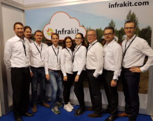
InterGEO brought worlds together

InterGEO brought worlds together

Companies in the land surveying field gathered at the InterGEO trade fair in Berlin on 26th – 28th of September to showcase their latest software, methods and tools. There were a lot more visitors than last year.
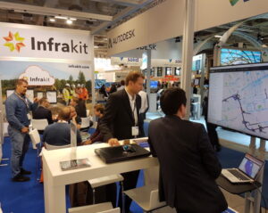
We had a booth at the fair where our team had the chance to tell people about the innovative way Infrakit makes it possible to monitor and manage construction sites. The booth bustled with people who were interested in learning more about what we do. Our booth was bigger than last year, but there was not that much more space because we had so many visitors.

We want to thank InterGEO and its partners, our amazing Infrakit team and everyone who came by to say hello!

Next year the InterGEO trade fair is held in Frankfurt on 16th – 18th of October, see you there!

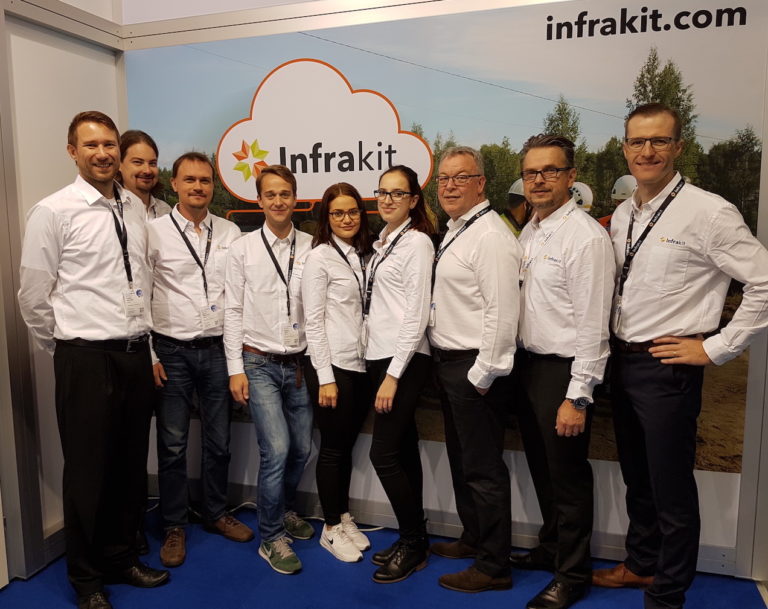
Our team (Cor and Toni are missing from the photo)

Our booth was bigger than last year

Book a Demo

Discover how Infrakit connects your entire infra project operations and drives value to every part of your business.
Infrakit Cloud makes construction more efficient

Infrakit Cloud makes construction more efficient

Thanks to Infrakit Cloud developed in Finland, a skilled foreman stays updated regarding project details even though machine control systems have made measuring sticks a thing of the past.
With the help of Infrakit and machine control it is possible to save up to 20% of the total cost of a project. The cost savings are made up of faster completion time, reduced loss of material, and avoided mistakes.

With the help of Infrakit and machine control it is possible to save up to 20% of the total cost of a project.

The project design files are entered in the online service and the system checks the information is usable in mobile and surveying instruments and in machine control. The only things needed are an Infrakit username and an internet browser. After this, the designs can be viewed on map on a mobile device or on PC. 3D visualization can also be done in the browser without the installation of any separate software. The cumbersome A2 paper designs are no longer needed in the field as all the data can be accessed on a smartphone or a tablet.

Infrakit serves as a centralized data storage for the project. When using Infrakit, the supervisor, the surveyors, the customer, the designer, and the work machines share the data through the service. The method makes the job of the surveying chief significantly easier when real-time data can be accessed through one service and it is automatically shared with the work machines, the foremen’s mobile devices and the surveying instruments. All measurement data from the project is collected to the service and the project progress can be monitored in real time.

Viewing material in the field using a tablet

The system connects different machine control systems and land surveying instruments under one service

The machine controlled work machinery is connected to Infrakit so the location of the machines can be viewed on the map. This way their efficiency can be monitored and the project designs are automatically shared. The as-built points measured by the machines appear on the map which makes it easy to monitor project progress as well as the quality compared to the designs.

Infrakit land surveying instrument

In a typical case, several machine control systems of different brands are used in a project. Without Infrakit, transferring all the data must be done separately through the cloud service of each software manufacturer. This causes extra work and increases the likelihood of mistakes, because there may be several different versions of the design files used by different people and machines in the construction site.

It is possible to connect all the most commonly used machine control systems to Infrakit, including Novatron, Leica, Topcon, and Trimple. This way all work machinery can be managed through one system, removing the need for extra work and reducing the risk of mistakes.

It is possible to connect all the most commonly used machine control systems to Infrakit.

It’s possible to connect the newest GNSS-rovers and total stations to Infrakit through the manufacturers’ own cloud services (for example ConX, Trimble Connected Community). Infrakit Cloud can be downloaded for android from Google Play Store. The application is used for viewing project designs and taking photos in the field. The application uses the in-built GPS-receiver of the device to locate the user and it shows the present location on the map, in the same way as Google Maps. The accuracy of location tracking on a tablet is 3-4 meters. If centimeter-level accuracy of the location is needed, the tablet can be connected to an external RTK-GNSS-receiver, making the application the foremen’s super tool, “the Infrakit surveying instrument”.

Measurements of the construction site and digital handover material

Infrakit collects digital handover material to one place. In an ideal case, the measurement data is automatically shared through an online connection. The system compares what has been built to the project design files and notifies the user of possible deviances. The measurements can be approved and the rights to view the project can be given to, for example, the project owner. The communication works significantly better when both parties can see the same project design and measurement data in the service.

In an ideal case, the measurement data is automatically shared through an online connection.

In the pilot project of the Finnish Transport Agency, Highway 8 Luostarinkylä, Infrakit has been used as a platform for collecting digital handover material and sending it to the project owner. The pilot study report (in Finnish) can be read from the following link: http://www2.liikennevirasto. fi/julkaisut/pdf8/lts_201715_digitaalinen_luovutusaineisto_web.pdf

Finnish National BIM guidelines will be updated this year to correspond the experiences in the pilot project.

It is easy to take photos from the field using the Infrakit tablet application. The photos are saved in the service and they are shown on the map together with their location. It is possible to add comments to the photos and the direction from which they were taken. Viewing photos and managing the map view is easy and the photos are usually organized into folders according to topics, which makes it easy to search for photos by topic and location.

Infrakit makes it possible to monitor the earth moving process in real-time. The truck drivers have the Infrakit Truck App in the cab where the loading and unloading locations as well as used routes and amounts of material are saved. The contractor no longer needs to carry around the logbooks and handle the data manually.

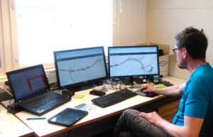
Infrakit in the site office

Independent Finnish know-how

The Infrakit service is actively developed in collaboration with Finnish construction companies and project owners. The headquarters of the company is in Helsinki and it’s owned by the employees. Infrakit is used in the majority of the most significant infrastructure projects in Finland. Projects in which Infrakit is utilized include the E18 Hamina-Vaalimaa project by YIT, the Highway 6 Taavetti-Lappeenranta project by Skanska and the Tampere Tramway Alliance.

Infrakit is the only independent cloud service in the market. As an additional note, importing the project design files is done using common open formats, so it can be done on any design CAD. The working principles of Infrakit makes it possible to use the surveying instruments and CAD-software most suitable for each task in a project, regardless of the supplier of the equipment and software.

Infrakit is the only independent cloud service in the market.

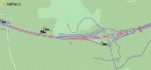
Map view

Book a Demo

Discover how Infrakit connects your entire infra project operations and drives value to every part of your business.
Digital Handover Material and Infrakit

Digital Handover Material and Infrakit

The benefits of digital handover material

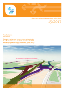
“Digital handover material” Finnish Transport Agency’s publication 15/2017

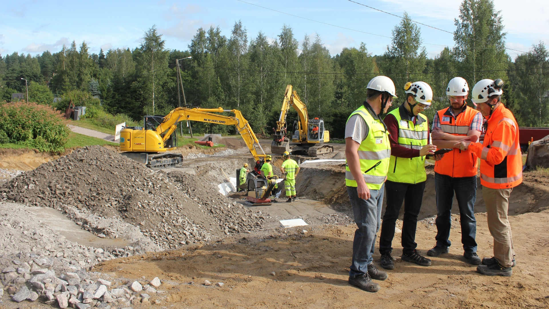
As production and designing in the field of infrastructure is becoming digital, it has been noted that the handover material is also good to have in digital form. Digital handover material makes the lives of the contractor and the project owner notably easier because nobody wants to collect or receive shovelfuls of cross-section images, surveying documentation and other reports. Infrakit offers a solution to this, as it makes it possible to collect the handover material in digital form in its cloud service.

Suntio’s report moves the field forward
The most important work regarding digitizing handover material this year is undoubtedly the “Digital Handover Material” by Ville Suntio and Anna Partiainen of Destia, which was published in the studies and reports series by the Finnish Transport Agency. The report describes how the digital handover material was collected using Infrakit in the Highway 8 Luostarinkylä project. The working group of the pilot project was very competent, including Kari Partiainen and Tiina Perttula of the Transport Agency and Petteri Salviainen of Novatron, who all made a valuable contribution to the project.

Read the whole report from here

Book a Demo

Discover how Infrakit connects your entire infra project operations and drives value to every part of your business.
Infrakit at the InterGEO Trade Fair

Infrakit at the InterGEO Trade Fair

Infrakit is going to participate again at the InterGEO trade fair that is held in Berlin this year.
Land surveying companies will gather in the trade fair center of Berlin 26th – 28th of September where they will be showcasing the newest software, methods and tools in the field.

You will find us in the exhibition hall 2.1, section B2.060. You’re welcome to say hi!

Would you like to experience the InterGEO trade fair with us? Fill out this form and we will send you a ticket!

It is also possible to make a personal appointment by email: tanja.heikkinen@infrakit.com or by calling +358 44 768 4010.

Infrakit at the InterGEO trade fair last year

Book a Demo

Discover how Infrakit connects your entire infra project operations and drives value to every part of your business.
Release Notes – Version 3.2.2-7

Release Notes – Version 3.2.2-7

Release Notes – Infrakit Office – Version 3.2.2-7
Bug
[IN-411] – Map page – Linecode logpoints should be grouped by date (not timestamp)
[IN-423] – Fix tablet login when latest chat messages query has been saved into request cache

Task
[IN-325] – MML Ortophoto map tiles in Finland
[IN-390] – Automatically calculate incoming logpoint distance to nearest alignment
[IN-410] – Find incoming logpoint alignment automatically
[IN-414] – Create png map tiles (/gmaps.png)
[IN-418] – Allow Mass Calculation Table distance and rows to be defined per project
[IN-422] – Change Organization.country to a set of valid countries

Book a Demo

Discover how Infrakit connects your entire infra project operations and drives value to every part of your business.