Infrakit Cloud makes construction more efficient
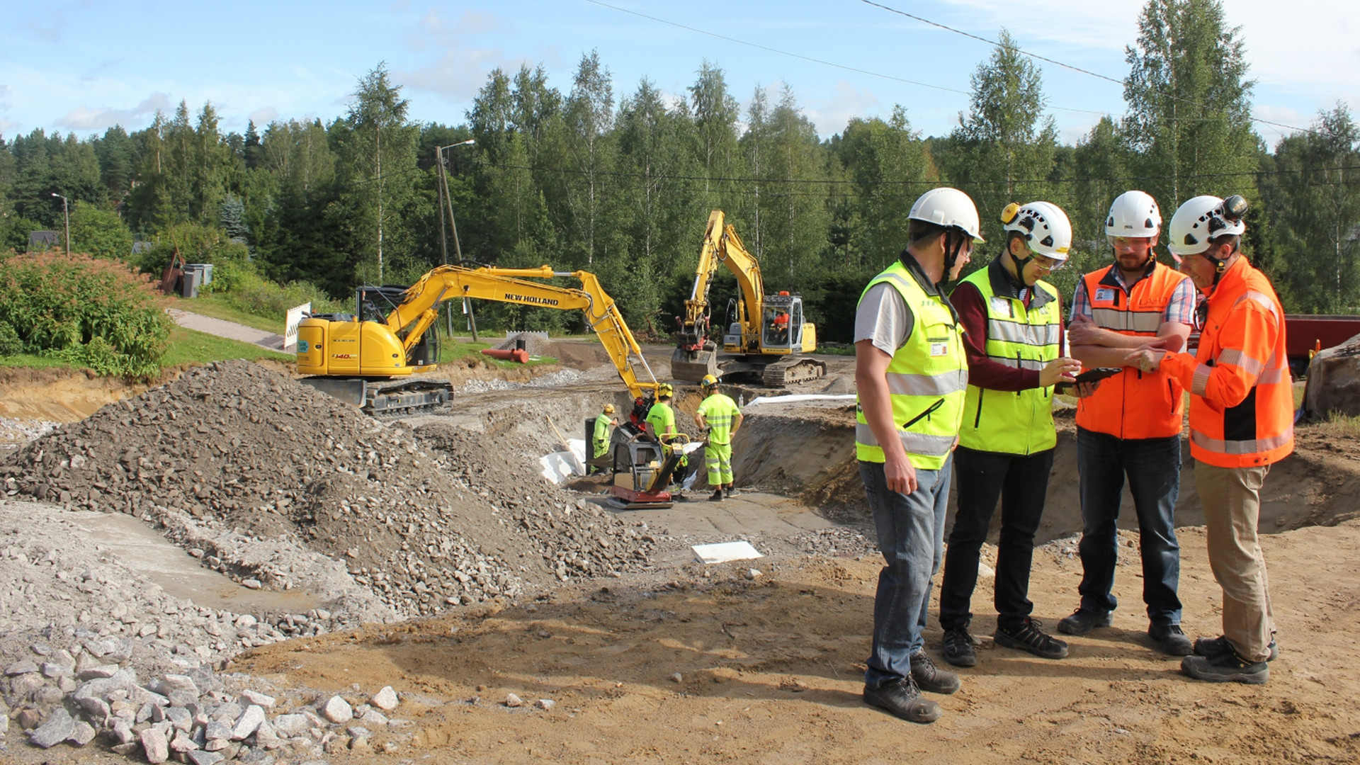
Infrakit Cloud makes construction more efficient

Thanks to Infrakit Cloud developed in Finland, a skilled foreman stays updated regarding project details even though machine control systems have made measuring sticks a thing of the past.
With the help of Infrakit and machine control it is possible to save up to 20% of the total cost of a project. The cost savings are made up of faster completion time, reduced loss of material, and avoided mistakes.

With the help of Infrakit and machine control it is possible to save up to 20% of the total cost of a project.

The project design files are entered in the online service and the system checks the information is usable in mobile and surveying instruments and in machine control. The only things needed are an Infrakit username and an internet browser. After this, the designs can be viewed on map on a mobile device or on PC. 3D visualization can also be done in the browser without the installation of any separate software. The cumbersome A2 paper designs are no longer needed in the field as all the data can be accessed on a smartphone or a tablet.

Infrakit serves as a centralized data storage for the project. When using Infrakit, the supervisor, the surveyors, the customer, the designer, and the work machines share the data through the service. The method makes the job of the surveying chief significantly easier when real-time data can be accessed through one service and it is automatically shared with the work machines, the foremen’s mobile devices and the surveying instruments. All measurement data from the project is collected to the service and the project progress can be monitored in real time.
Viewing material in the field using a tablet

The system connects different machine control systems and land surveying instruments under one service

The machine controlled work machinery is connected to Infrakit so the location of the machines can be viewed on the map. This way their efficiency can be monitored and the project designs are automatically shared. The as-built points measured by the machines appear on the map which makes it easy to monitor project progress as well as the quality compared to the designs.
Infrakit land surveying instrument

In a typical case, several machine control systems of different brands are used in a project. Without Infrakit, transferring all the data must be done separately through the cloud service of each software manufacturer. This causes extra work and increases the likelihood of mistakes, because there may be several different versions of the design files used by different people and machines in the construction site.

It is possible to connect all the most commonly used machine control systems to Infrakit, including Novatron, Leica, Topcon, and Trimple. This way all work machinery can be managed through one system, removing the need for extra work and reducing the risk of mistakes.

It is possible to connect all the most commonly used machine control systems to Infrakit.

It’s possible to connect the newest GNSS-rovers and total stations to Infrakit through the manufacturers’ own cloud services (for example ConX, Trimble Connected Community). Infrakit Cloud can be downloaded for android from Google Play Store. The application is used for viewing project designs and taking photos in the field. The application uses the in-built GPS-receiver of the device to locate the user and it shows the present location on the map, in the same way as Google Maps. The accuracy of location tracking on a tablet is 3-4 meters. If centimeter-level accuracy of the location is needed, the tablet can be connected to an external RTK-GNSS-receiver, making the application the foremen’s super tool, “the Infrakit surveying instrument”.

Measurements of the construction site and digital handover material

Infrakit collects digital handover material to one place. In an ideal case, the measurement data is automatically shared through an online connection. The system compares what has been built to the project design files and notifies the user of possible deviances. The measurements can be approved and the rights to view the project can be given to, for example, the project owner. The communication works significantly better when both parties can see the same project design and measurement data in the service.

In an ideal case, the measurement data is automatically shared through an online connection.

In the pilot project of the Finnish Transport Agency, Highway 8 Luostarinkylä, Infrakit has been used as a platform for collecting digital handover material and sending it to the project owner. The pilot study report (in Finnish) can be read from the following link: http://www2.liikennevirasto. fi/julkaisut/pdf8/lts_201715_digitaalinen_luovutusaineisto_web.pdf

Finnish National BIM guidelines will be updated this year to correspond the experiences in the pilot project.

It is easy to take photos from the field using the Infrakit tablet application. The photos are saved in the service and they are shown on the map together with their location. It is possible to add comments to the photos and the direction from which they were taken. Viewing photos and managing the map view is easy and the photos are usually organized into folders according to topics, which makes it easy to search for photos by topic and location.

Infrakit makes it possible to monitor the earth moving process in real-time. The truck drivers have the Infrakit Truck App in the cab where the loading and unloading locations as well as used routes and amounts of material are saved. The contractor no longer needs to carry around the logbooks and handle the data manually.
Infrakit in the site office

Independent Finnish know-how

The Infrakit service is actively developed in collaboration with Finnish construction companies and project owners. The headquarters of the company is in Helsinki and it’s owned by the employees. Infrakit is used in the majority of the most significant infrastructure projects in Finland. Projects in which Infrakit is utilized include the E18 Hamina-Vaalimaa project by YIT, the Highway 6 Taavetti-Lappeenranta project by Skanska and the Tampere Tramway Alliance.

Infrakit is the only independent cloud service in the market. As an additional note, importing the project design files is done using common open formats, so it can be done on any design CAD. The working principles of Infrakit makes it possible to use the surveying instruments and CAD-software most suitable for each task in a project, regardless of the supplier of the equipment and software.

Infrakit is the only independent cloud service in the market.
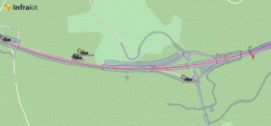
Map view

Book a Demo

Discover how Infrakit connects your entire infra project operations and drives value to every part of your business.
Digital Handover Material and Infrakit

Digital Handover Material and Infrakit

The benefits of digital handover material

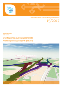
“Digital handover material” Finnish Transport Agency’s publication 15/2017

As production and designing in the field of infrastructure is becoming digital, it has been noted that the handover material is also good to have in digital form. Digital handover material makes the lives of the contractor and the project owner notably easier because nobody wants to collect or receive shovelfuls of cross-section images, surveying documentation and other reports. Infrakit offers a solution to this, as it makes it possible to collect the handover material in digital form in its cloud service.

Suntio’s report moves the field forward
The most important work regarding digitizing handover material this year is undoubtedly the “Digital Handover Material” by Ville Suntio and Anna Partiainen of Destia, which was published in the studies and reports series by the Finnish Transport Agency. The report describes how the digital handover material was collected using Infrakit in the Highway 8 Luostarinkylä project. The working group of the pilot project was very competent, including Kari Partiainen and Tiina Perttula of the Transport Agency and Petteri Salviainen of Novatron, who all made a valuable contribution to the project.

Read the whole report from here

Book a Demo

Discover how Infrakit connects your entire infra project operations and drives value to every part of your business.
Infrakit at the InterGEO Trade Fair

Infrakit at the InterGEO Trade Fair

Infrakit is going to participate again at the InterGEO trade fair that is held in Berlin this year.
Land surveying companies will gather in the trade fair center of Berlin 26th – 28th of September where they will be showcasing the newest software, methods and tools in the field.

You will find us in the exhibition hall 2.1, section B2.060. You’re welcome to say hi!

Would you like to experience the InterGEO trade fair with us? Fill out this form and we will send you a ticket!

It is also possible to make a personal appointment by email: tanja.heikkinen@infrakit.com or by calling +358 44 768 4010.

Infrakit at the InterGEO trade fair last year

Book a Demo

Discover how Infrakit connects your entire infra project operations and drives value to every part of your business.
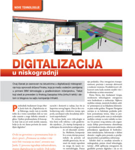
Release Notes – Version 3.2.2-7

Release Notes – Version 3.2.2-7

Release Notes – Infrakit Office – Version 3.2.2-7
Bug
[IN-411] – Map page – Linecode logpoints should be grouped by date (not timestamp)
[IN-423] – Fix tablet login when latest chat messages query has been saved into request cache

Task
[IN-325] – MML Ortophoto map tiles in Finland
[IN-390] – Automatically calculate incoming logpoint distance to nearest alignment
[IN-410] – Find incoming logpoint alignment automatically
[IN-414] – Create png map tiles (/gmaps.png)
[IN-418] – Allow Mass Calculation Table distance and rows to be defined per project
[IN-422] – Change Organization.country to a set of valid countries

Book a Demo

Discover how Infrakit connects your entire infra project operations and drives value to every part of your business.
Release Notes – Version 3.2.2-6

Release Notes – Version 3.2.2-6

Release Notes – Infrakit Office – Version 3.2.2-6
Bug
[IN-383] – MachinePage->Calibration tab: not possible to add decimals
[IN-385] – long section alignment line is calculated from break lines resulting in an inaccurate alignment graph
[IN-387] – After deleting logpoints, the logpoints list is not automatically refreshed. The list refreshes and logpoints disappear only after manually clicking the folder containing the points.
[IN-392] – Admin edit organization selects the wrong parent organization by default
[IN-397] – Remove project.vehicles entity mapping to prevent circular Hibernate update chains.
[IN-398] – Changing vehicle models crashes if vehicle has been assigned a deleted model
[IN-401] – Inframodel xml profile sometimes starts from wrong station

Task
[IN-323] – Map page images – thumbnails multiple selection
[IN-365] – Maps page – Add close button to data properties windows
[IN-386] – long section graph should have controls to adjust yScale
[IN-402] – Add more visible highlight coloring on the selected item on map page left tab menu..
[IN-403] – TCC integration – Upload lone svl as a model file
[IN-404] – Topcon integration – Convert line data to ln3
[IN-407] – Reduce unauthenticated user session timeout to 5 minutes
[IN-408] – Run UserLog save in a single thread

Book a Demo

Discover how Infrakit connects your entire infra project operations and drives value to every part of your business.
What’s happening at our Serbian office?

What’s happening at our Serbian office?

Activities in Serbia
Developers from Serbia had a noticeable part in building the Infrakit brand since the early beginnings of the company. We will fill this blog post with a triptych of subjects regarding our Belgrade office.

Marketing

Marketing and educational activities in Serbia took their peak in the year of 2016. The Finnish embassy was kind enough to let us make use of the residence space to gather the creme of the Serbian civil engineering community. Invitations were sent out and in our attendance we had ministers of the state, representatives of the domestic and foreign construction companies, surveyors, members of the chamber of engineers, academics. The topic was presentation of the future technologies in the Civil Engineering, which, as you know, Infrakit is a forerunner in. We wish to thank His Excellency Mr. Pertti Ikonen and his team one more time, and also Mr. Nenad Tepavac who was our sales manager in that period. Read about the event from here.

2nd International Civil Engineering Congress

One of the guest lecturers on our February event at the Embassy was our important associate, professor Dr. Gavran from the Construction faculty in Belgrade. His fame and experience in the field is topped only by GMC AutoCAD add-on that he developed, which is used in designing phase of many important construction projects in many countries. The second event took place after we were honoured by invitation from professor Gavran to present Infrakit software to the top students in a class at the University.

JavaScript Meetup

The last major event was our participation at the 2nd International Civil Engineering Congress at the Crown Plaza hotel in Belgrade. The event was opened by Serbian Minister of Construction, Transport and Infrastructure. Our presentation, which was worth certain amount of academic points, involved case study about one of the pioneering Infrakit projects in Finland and is co-authored by our CEO Mr. Teemu Kivimäki.

PUT Plus

In other news, we had private meetings with many domestic construction, quality control and related companies (such as state railways), and published a few articles like those in the Adriatic area Civil Engineering Almanac named Put Plus. We concluded that the digital awareness in this Serbian sector is just not yet ready for such innovations, but we will be ready when that happens. DCS Finland efforts are currently focused on the more developed markets where the sales and marketing teams are doing a wonderful job in broadening our user base. However, we became a talk of the town across the industry and if any technological or scientific problem occurs in the future work of Infrakit, we will certainly have exceptional help from our friends in Serbia.

IT Scene

Serbia has been country of choice for many foreign IT companies for years. Its proven educational system in natural sciences field and affordable services make a ratio which attracts many IT companies for outsourcing, offshoring or near-shoring, you name it, kind of business model. For instance, Belgrade is one of few cities where Microsoft found home to it’s Development Center offices. The other proud example is the High School of Mathematics, which is renowned worldwide for it’s students who are seldom returning from the Mathematical Olympiad without golden medals. The truth is that many students are leaving the country, but also many are staying because of the opportunities in the IT field.

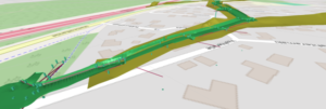
3D visualization

Let us not ignore the domestic companies which left huge impact on the IT scene. Top Eleven, the manager game that came out of Nordeus is played by million of players on a daily basis. Devana technologies, which produced the most popular WordPress managing platform, was acquired by worlds biggest Internet domain name registrar company GoDaddy a couple of months ago, thus making that company’s debut in Europe.

In the past months the government has noticed the great potential of the IT sector. The state promised a plan of benefits for the IT companies and startups, which should only lead to more favourable connection between the offices. Also, there is more than one NGO which is involved in the scene in very positive way, like hosting free or paid events and lectures.

Recruitment

That leads us to the recruitment of new software engineers. Similar to Finland, the demand for the coders has skyrocketed and the typical strategy of the IT companies is to offer internships and hunt pre- or post-graduate students. It has never been the better time to be a software engineer student in a business environment which didn’t exist ten or more years ago. Infrakit is lucky to have great coders with a degree in its Serbian office, and this small team already have had the pleasure to welcome in its rows some of the now very successful IT individuals. Aleksandra is now the producer of the Mad Head Games, Milan has his own 50+ people IT software engineering outsourcing company, and David who excelled 3D module to the current standard in his freshman year, got an internship at Microsoft.

The author of this blog post, Ognjen Popović, is also the contributing author to the oldest Serbian computer magazine, which got its fame during the time of Yugoslavia. He is often attending domestic and international IT events, like the Voxxed days which was held in the Belgrade last year, and is also a member of jury in a competition held by Computer Science Faculty in Serbia, which happens to be the place where most of our coders came from.

Lastly, let us mention the growing culture of IT meetups (entrepreneurs, developers, startups), where people from across the industry gather to promenade, share knowledge and network together. I think it is safe to conclude that we are in the right place to offer future work positions both for internships and senior coders as our company expands. Of course, everything in coordination with the band of coders come from the home offices in Finland.

The author of the article is currently mainly developing Infrakit App for iOS Devices, which might be a good topic for blog post.

Book a Demo

Discover how Infrakit connects your entire infra project operations and drives value to every part of your business.