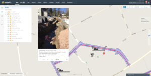
Why Infrakit Apps?

Why Infrakit Apps?

What would it mean to your infra-projects if the staff, machinery and software all shared a mutual, easy-to-use map-based cloud platform? You would always have access to up-to-date situational information. You could utilize the information no matter if you’re working on your laptop or Android device. You could also easily add to the project information with geo-and design-referenced images, measurements, documents and comments.
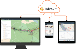
Digitization and cloud services have arrived to all infra construction sites no matter the size of the organization, processes they use, mobile device/survey equipment/machine control system preferences and that is because of Infrakit. Infrakit is a great example of using a cloud service to utilize digital information in a very traditional industry.

Infrakit improves collaboration by facilitating on a map project’s all relevant information on your PC browser or mobile device. Our cloud manages to read and interpret all machine control system manufacturers’ designs and measurements. Infrakit App was created for worksite use. You can view design maps and models uploaded to Infrakit easily on your Android device (coming soon for iOS!), and you will get real-time as-built measurement data on your smartphone or tablet. You can also add comments or take pictures to rise to the next level in data sharing and worksite communication efficiency!
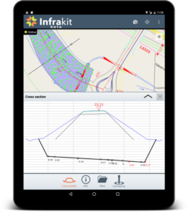
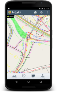
Using their Android tablets all survey personnel, work machine drivers and foremen utilize and create information, all of which is shown centralized on a map view and in real-time. In addition to the Infrakit web service, the App is a tool for foremen and surveyors, but it’s also a handy tool for anyone who wants to be on top of the latest project information and be able to access real-time design- and measurement data.

You can read more from here and here.

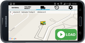
We also have great App for Truck Tracking, read more about that here.
For more information and login information, please ask Pasi Joensuu (Pasi.joensuu@infrakit.com)

Book a Demo

Discover how Infrakit connects your entire infra project operations and drives value to every part of your business.


Infrakit News from the Netherlands!

Infrakit News from the Netherlands!

Dear readers,

There is a lot going on in Netherlands at the moment. First of all, we have an agreement with a company called Digital Infra Solutions who will be our reseller and service provider. This company has experienced people from different aspects in the infra market and can help you very well with all issues related to digital infra-construction.

With the great help of Digital Infra Solutions new projects will be using Infrakit and the first one is Combinatie Herepoort in Groningen. This is a 4-year project where a ring road will be transformed in a high way ring road. The existing road is a cause of traffic congestion, because there is a lot of traffic and most of it is on same level, so there is a lot of traffic controlled by traffic lights. This road is on +6m level.

The new road is going to be on -6m level and all local traffic will stay on +6m level. This way traffic just passing the city will not be disturbed anymore by the local traffic and vice versa. It is a 400 million Euro project created by 4 local construction companies (Roelofs Wegenbouw BV, Jansma Drachten BV, Koninklijke Sjouke Dijkstra BV and Oosterhof Holman Infra BV) and 2 German companies through their Dutch subsidiaries (Max Bögl Nederland BV and Züblin Nederland BV).

Fig. 1: Impression of new situation of one part of the project

This project has started already and will continue for the next 4 years! Wishing them a successful project and implementation of Infrakit Cloud Service!

The other good news is that one of the biggest companies in infra-construction in Netherlands has become a customer! After using Infrakit at a pilot project and seeing the great results using Infrakit they have decided that they will use Infrakit for all relevant projects! We welcome company Heijmans N.V. as a customer. Heijmans is a stock listed company and has very nice projects coming up and going on. One of the new project that will start this month is the so called 3Angle project, which will be done in combination with 3i Infrastructure and Fluor. This is a project where 2 highways will be widened from 2×3 to 2×4 lanes and from 2×2 to 2×3 lanes. Have a look at this.

Fig. 2: Impression of a new connection of local roads with the expanded highway.

Of course, nature will get a lot of attention as well. Look at this eco tunnel!

Fig. 3: Impression of the Eco tunnel

We wish Heijmans and the combination partners a successful project and a successful implementation of our Infrakit Cloud Service!

One of the great advantages of using Infrakit in these kind of projects is that there is always a mixed fleet of machine control brands on the project. Infrakit can handle them all!

Do you want to know more? Don’t hesitate to contact us and we will demonstrate you how!

Kind Regards,

Jan van den Brandt
Infrakit B.V.
T: +31 655735500

Verlengde Maanderweg 100
6713 LL Ede
Netherlands

Book a Demo

Discover how Infrakit connects your entire infra project operations and drives value to every part of your business.

Release Notes – Version 3.2.2-4 & Version 3.2.2-5

Release Notes – Version 3.2.2-4 & Version 3.2.2-5

Release Notes – Version 3.2.2-5
Bug
[IN-388] – Admin Organizations page list headers are in wrong order
[IN-389] – mobile.infrakit.com sometimes uses Infrakit Office active project
[IN-391] – Separate files can have same versionGroup if multiple people upload files at same time

Release Notes – Version 3.2.2-4
Bug
[IN-354] – DWG to DXF converter might get stuck
[IN-356] – Fix the case where vehicle vendor id might be 0
[IN-359] – Show vehicle station when vehicle is outside the main alignment
[IN-367] – Inframodel pipe height is wrong if pipe elevType=”crown level”
[IN-371] – Point source filename is not always shown
[IN-373] – Sitelink integration – Fix file sync when only some of the vehicles in a project have new models

Task
[IN-246] – Draw long-section page
[IN-351] – Show logpoint pointname in logpoints page
[IN-357] – Change ConX integration url to conx.leica-geosystems.com
[IN-358] – Calculate file size and md5 when receiving the file from user
[IN-361] – Clicking a notification pans and zooms to the area on map where the notification happened
[IN-368] – Translate Infrakit to Estonian
[IN-369] – Add Swedish geoid swen08 rh70
[IN-370] – Also create directories without any files when uploading zip file
[IN-374] – Vehicles page – Add link to admin edit vehicle if user is admin

Book a Demo

Discover how Infrakit connects your entire infra project operations and drives value to every part of your business.

Release Notes: Infrakit Version 3.2.1

Release Notes: Infrakit Version 3.2.1

Infrakit Office cross section pan & zoom is now live. Also bugs fixed.

Bug

[IN-276] – New maps page – Free cross section tool should always be available
[IN-292] – Integration logins sometimes not visible in the admin edit project page
[IN-298] – Free cross section draw view is limited by the station location in y-direction sometimes resulting in an empty cross section canvas.
[IN-300] – Cross section screen models, logpoints and pipes check boxes are not saved properly
[IN-301] – Web cross section logpoint checkboxes are horizontally miss aligned with mouse click
[IN-318] – When opening cross section graph, pan graphs in y-direction so that alignment/station is always visible.
[IN-320] – Approval edit does not work
[IN-321] – Project code list not initialized on map initialize
[IN-322] – Fix Icon Telematics logpoint reference model matching
Task

[IN-242] – Web cross section pan & zoom
[IN-256] – Cross section show/hide pipes
[IN-284] – Remove alignment id requirement from free cross section
[IN-312] – Change cross section graphs canvas size to scale with the window size.
[IN-313] – Add model’s file name to graphs, pipes and logpoints hower tool tips in cross section view

Previous release notes: Version 3.2.0 & new map page

Book a Demo

Discover how Infrakit connects your entire infra project operations and drives value to every part of your business.

Meet the Serbian team!

Meet the team:
Our manpower in Belgrade peaked with maximum count of five members in early-2016, while it’s currently stable with three coders.


Ognjen Popović – Regional Manager Eastern Europe

I had a chance to do business with Mr. Teemu Kivimäki prior to Infrakit, and I am happy that I had the opportunity to join the Infrakit endeavour after Teemu put it on the right track. My job consists of doing everything related to the Belgrade office, from handling the office space, setting up hardware and software, recruiting and basically both PR and HR which were moderately needed so far.

I’ve been coding using several technologies, incl. development of embedded software that resides on the construction site vehicles, got into CAD and CG design and the work I am probably most proud of is development of the mathematical formulas for transitioning curves we are displaying in our software. Prof. Srđan Vukmirović from Faculty of Mathematics in Belgrade was kind enough to help me with the math problems, which later led me to achieve my master thesis.


Predrag Kerčov – Software Developer

First task Predrag got was to improve worksite mass calculations. He is mostly doing what is called back-end or server coding.

Predrag is now also involved in Android development, currently improving the Truck Tracking and Infrakit applications, but still working on the web application when needed.


Nikola – Front-End Developer, Designer

Nikola is master coder (both in academic degree and skill-set) and a designer. His front-end coding skills resulted in the Infrakit web application and Infrakit website implementation, both visually and in the code under the hood. Lately he has also been working on back-end.

From time to time he is working together with Pipsa (Marketing), when there is a need for any kind of graphic design: brochures, ads – online and offline.


At the plateau near the office

We are all occasionally in direct communication with Infrakit clients over Internet calls adapting our solutions according to their feedback. More or less, all of us had or will have chance to travel and visit worksites and take a look of Infrakit use in real working conditions.

Read the previous post about what we have been doing more in detail from here.

New Infrakit map page – Infrakit version 3.2.0 live!

New Infrakit map page – Infrakit version 3.2.0 live!

Last night (20.3.), Infrakit was updated to version 3.2.0.

In this update, we have completely reworked the main map page based on your feedback. Old map page is still available if you need it, but we are confident that the new and improved page will be a lot more versatile and easy to use for your needs. New features include, for example, improved management of photos and as-built points directly on the map page, among numerous others. Also some bug fixes and other features were done. You can find the complete list of changes below.


New map page

If you have any questions or comments, please don’t hesitate to contact us or your local Infrakit reseller!

Best regards,
Teemu Kivimäki
Infrakit
Founder and CEO
infrakit.com


Version 3.2.0 release notes:
Bug fixes

[IN-25] – After accepting project invitation, user temporarily has full rights to project
[IN-279] – New maps page doesn’t work if user has no saved state
[IN-302] – Prevent moving folder into own subfolder
[IN-303] – Ignore invalid characters in Icon Telematics when matching Icon Telematics filenames.
[IN-305] – Mass page bug fixes
[IN-306] – New maps page: unselecting model with features does not remove the features from map
[IN-308] – New maps page – Show on map from Images page does not work

Epics

[IN-299] – New maps page in OpenLayers

Tasks

[IN-7] – Add logpoint filters to main page
[IN-24] – Infrakit tablet – take photo, add ability to select folder
[IN-244] – Add support for Trimble TCC subcontractor machines
[IN-277] – New maps page – Add gray background maps
[IN-283] – New maps page – Show logpoints count in folder
[IN-297] – Draw arrow to show cross section direction
[IN-304] – Allow relaticsonline.com to open Infrakit in an iframe

Book a Demo

Discover how Infrakit connects your entire infra project operations and drives value to every part of your business.