GUEST POST: Digitization and Transparency are Advantages also in Infrastructure Construction

GUEST POST: Digitization and Transparency are Advantages also in Infrastructure Construction

Digitization and Transparency as Assets
(Written by Teemu Tervahauta)

Improving productivity and competitiveness in general has lately been publicly discussed in Finland. Luckily, concrete actions have been taken in order to improve productivity in infra-construction industry. BIM has gained a significant role in larger infrastructure projects already.

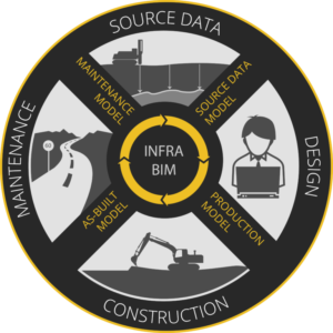
The basic idea of BIM is processing project data in an open, digital format instead of paper documentation so that the data can be utilized and shared more diversely. Fundamental in BIM utilization is lifecycle thinking, and seeing the big picture of the project instead of a single work phase at a time. Comprehensive modelling might increase designing costs but it can also save you a remarkable amount of money during the construction phase.

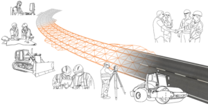
With BIM project information is transferred in an open, digital format from one phase to another

Transparency and Compatibility

What does transparency exactly mean and why should you strive for it? It is about how machinery, software and systems connect with one another. The question is justifiable since many worksites have various manufacturers in use, such as 3D machine control systems.

If the machine control system in use at your worksite requires designs in a manufacturer-dependent file format, the design data typically has to be converted into their own format with their own software. Format conversion is an additional work phase and, in addition, the metadata included in the original designs can be left out in the converted format. If the machine control system reads open formats instead, the processes will become more streamlined and irrelevant, extra activities will be eliminated.

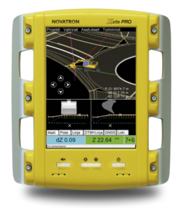
From the 3D machine control system’s screen excavator driver sees how much needs to be excavated at any given point. Novatron’s Xsite PRO system fully utilizes Inframodel3 models – including metadata.

Open Standard

In Finland, an open LandXML -based Inframodel3 -data transfer standard has been developed as a result of cooperation of several active parties. It is not just about file format but about diversely utilizing metadata of the modelled objects, such as codes and names.

Inframodel3 can be perceived as ‘intelligent’ data whereas the old data transfer formats, like dxf, represent ‘un-intelligent’ information. Inframodel3 loses its meaning if it is being used as a format among other formats. Full utilization of metadata is key to efficient use of Inframodel3.

On today’s infra-construction worksites digitization and transparency are therefore assets. Data modelling and 3D machine control represent ways of working that help infrastructure projects to be implemented more efficiently than before. Improving productivity does not result in increasing the hours worked, but in completing the work smarter than previously!

Infrakit also represents transparency. As a platform-independent worksite management service, it works with machine control systems by different manufacturers.

The author, Teemu Tervahauta, is the Business Development Manager of Novatron Ltd., Novatron.

Editor’s note: This post is first in our Guest Post series where infra-construction experts and experienced doers tell about the transformation of infra-construction industry, digital leap and new winds of change in the industry. The posts are written by the authors themselves and the texts have not been edited (except a word-for-word translation into English).

Book a Demo

Discover how Infrakit connects your entire infra project operations and drives value to every part of your business.

Infra-Construction in Year 2020

Infra-Construction in Year 2020

Paving the way for a digital revolution in infra-construction

Governments and other infrastructure owners around the world are paying the costs of inefficient and outdated construction methods. Hundreds of millions of euros are being wasted in antique work planning and building based on inaccurate paper designs. As each project is unique, the construction site is currently largely an ad-hoc operation, where work is being implemented according to the experience and vision of old school professionals and based on weekly meeting and communication by phone calls and paper.

From traditional..

What has always been, doesn’t have to stay that way for eternity

As infrastructure projects always include unexpected details due to unforeseen terrain qualities, the current but outdated methods cause a lot of waiting and wasted time. We see this as work machinery utilization rates as low as 20 to 30 % of scheduled working hours. Huge amounts of expensive heavy machinery hours, such as excavators and bulldozers, are being wasted and the project completion time is unnecessarily prolonged to double or even triple.

This is all going to change in a couple of years, and what we will see in year 2020 is more of a factory or process engineering style approach. Detailed pre-planning and scheduling, real-time tracking and project transparency will enable project managers to adapt to events on field and enable drastically shorter project completion times. On a high level this fundamental change in project management is called digital construction.

How does change happen?

..to new and improved.

There are several key steps that will be taken in the coming years. Design engineers and project owners need to embrace the real data needs of the construction work instead of thinking about traditional paper designs. This means using standards like the LandXML-based InfraBIM guidelines that are a government requirement in Finland (infrabim.fi).

Once the project has been modelled, detailed and accurate realization plans and schedule can be derived. This same model can also be used in work machinery which will semi-automatically implement the designed earthwork structures using high accuracy GPS/GNSS technology. Machinery will also automatically document the work phases they have implemented.

This all can be monitored online in real time and any deviations from designs or possible problems can be quickly dealt with. Mass hauls are preplanned and online systems track movement of all transport vehicles such as dump trucks. A projected completion time of any project task can be calculated online based on the current performance with assigned machinery. Additional resources can be dynamically added into critical path tasks to ensure they are completed according to planned schedule.

Infra-construction site where everyone and everything is connected

All equipment that is being installed, such as rail tracks, pipes and manholes, will have ID tags for tracking. Their current location and installation dates are known so their transportation and installation work can be accurately planned and monitored. The worksite has an online inventory and quota of all the needed parts and materials for the entirety of the project.

On-site personnel all have access to the site plans, schedule and current situation. They have a clear view of the tasks, where the project is today and what are the plans for today, this week, next month.

Infra-construction in a turning point

What the industry needs is open digital standards and true interoperability. More communication between design and construction phases of the project and integrations between different software and hardware systems. In the end, it’s all about collecting, sharing and distributing data.

The year 2020 is basically just around the corner and digital infra-construction is already here to stay.

Are you content with the traditional methods or ready to join the revolution?

Book a Demo

Discover how Infrakit connects your entire infra project operations and drives value to every part of your business.

Business Opportunities for Land Surveying Companies

Business Opportunities for Land Surveying Companies

Infrakit enables new business possibilities for land surveying companies

With Infrakit, it’s possible for land surveying companies to serve their construction company customers in a brand new, deep and exciting way. Using Infrakit land surveyors have a possibility to provide site foremen and managers an unprecedented real-time view into the progress and quality of their site.

Design and surveying information can be made available any time, with the use of internet browser or an Android field tablet computer. Tablet computers or mobile phones can be distributed to excavator and dump truck drivers enabling them to become part of the real-time site information flow.

Infrakit is looking for partners in land surveying companies to bring the digital revolution to work sites around the world!

GNSS surveying equipment (used by land surveyors, foremen and supervisors) and 3D machine control equipment fitted on work machinery can also be directly integrated with Infrakit to provide real-time data sync over the internet.

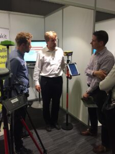
Toni shows Infrakit’s compatibility with GNSS devices

This means that any GNSS device on the field can be used to make measurements using designs and other data from Infrakit, removing the need for a pre-measuring data-prep work phase.

As land surveyors are experts in handling digital data, we see that their role will further increase in the coming years as new mobile tools such as tablets are adopted on the field.

Read more about the integration between GNSS equipment and Infrakit Android App here.

If you want to become a part of the Infrakit family, please contact us here or directly email our CEO Teemu Kivimäki teemu.kivimaki@infrakit.com.

Published originally: 30th of Sep, 2015.

Book a Demo

Discover how Infrakit connects your entire infra project operations and drives value to every part of your business.

Die Like Dinosaurs or Go Digital

Die Like Dinosaurs or Go Digital

BIG D IS HERE

Are you ready? (Infra magazine 2/2016)

Digitization has come here to stay. It’s not just a small jump, it’s a big leap – if you haven’t taken the first step yet, now it’s time to hurry. Jump in and claim your place under the Big D sun.

Text by Sari Okko, translated by Nina Aro & Pipsa Aro, Infrakit

Chairman of Andament Group Matti Juola knows that. The concept of digitization is pushed from all forums, but it is still unclear and distant to many. Hyping it can be even annoying.

“It’s not a bogeyman, but the concept may be difficult to understand. When at work your hands are full and feet deep in clay, it’s challenging to get on top of the digitization wave,” Juola admits.

Despite prejudice and vagueness it’s better to start getting digital today rather than tomorrow or next week. “Even though you might feel like pushing it aside and out of mind, it’s not possible anymore”, says Juola.

Get it Done, but How?

“It’s most important to approach it consistently. Start researching it, get information, reserve some time and simply just think what it’s all about, what to do and how much, how and for how long, and what it generally means”, Juola answers.

“It is obvious that not every company needs to be on the crest of the wave but all of them should think what digitization, automation and robotisation could mean to their business. Everything depends on the management. Digitization should become a part of the strategy and business planning. You can’t outsource this job thinking that digitization is just about IT, devices and software that previously was simply ordered and bought from a store.”

“In infra-construction digitization as an issue is bigger and more complex than just buying a new excavator. Digitization is inevitably and increasingly working its way into everyday work, changing job descriptions and making some activities unnecessary.”

Juola recommends to roll up your sleeves. “When you take your time adopting digitization and think about the strategy carefully, you won’t find yourself rushing hurryingly through it.”
Do We Need New Digital Management?

According to Juola, digitization concerns companies of any size and the entire work community. New type of “digital management” is not completely necessary if change management is prepped with fresh insight on digitization viewpoints.

Relevant expertise is not always found in-house, even if company was filled with seasoned specialists. It’s not easy to adopt new views and working methods if you are used to doing things traditionally.

“For startups it’s common to consult Senior Advisers, but in case of digitization, companies should ask for Junior Advisers’ vision and knowledge”, Juola contemplates.

Juola doesn’t think digitization is only for the young, even though “facsimile and email generation” sees “Social Media generation” as the digitization age group. “In times of change you need new expertise, but it doesn’t mean older generation couldn’t learn new methods. Nowadays you must continuously update your expertise.”

First Big Companies, Then the Small?

During his career Juola has seen many trends come and go. Digitization is not one of the shooting stars or a passing phenomenon. “Change is constant and there is no going back to old”, assures Juola.

In infra-construction the spectrum of digitization expertise is now as wide as companies themselves. When some are taking digital leaps, others are just learning how to use email – roughly speaking. “Some bigger companies are already on the crest of the digitization wave which is a great thing. Actions of big companies open doors and create awareness and attractiveness for smaller players as well.”

Juola calls for open-mindedness and focusing on entities. “We Finns tend to get excited and rush into smaller things without seeing the big picture. In practice we need enough firepower to get into new markets. New business will eventually need to be seen in the financial results.”

What’s the Point of Big D?

Construction industry already benefits from digitization. It means that the 565 billion euro industry has a chance to stand out and improve its productivity and competitiveness. Surge in productivity due to digital leap is a big opportunity for the economy.

Juola wants to bring out the opportunities of digitization and clear the way for its progress.

“Digitization provides customers with comprehensive service and adds value to the products. Digitization reduces manual logs and mistakes, automates routine tasks like calculation, data recording and processing. Digitization simplifies processes, streamlines operations, and adds transparency and opportunities for tracking and measuring activities in real-time. Productivity and effectiveness improve when you can do more and better quality with the same resources. Drafting new business models can be difficult, but it’s worth to dig and try out different opportunities. With the right attitude and openness you can get pretty far.”

Mobile in the Field

Nevia’s (part of Andament Group) mission is to make transportation safer with modern technology: by measuring the amount of traffic, analysing traffic jams and condition of pavement, and developing smart traffic services and software.

The company has experience in providing road services for the Finnish Transport Agency, Centres for Economic Development, Transport and Environment, municipalities and individuals. Their core expertise is mobile “asphalt pavement quality control measuring” which they implement thousands of kilometres of measurements a year.

“Nevigator system is developed to record terrain observations. It all started because we needed a mobile tool for terrain workers. We focused on usability, business agility, improving cost-efficiency and simplifying operations”, Juola explains.

“With this system the whole organisation receives prompt observations on road surface friction, damaged pavement and broken light or safety devices. Information about water slot depth and road surface slope helps prioritizing maintenance projects.”

Matti Juola urges us to try out digitization already today than tomorrow. Being too busy is not enough of an excuse.
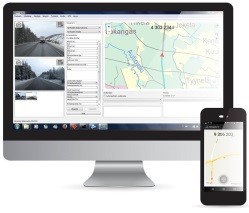
You can use Nevigator on desktops for example in quality control of winter maintenance.
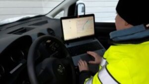
Nevia’s Nevigator data collection system is used in road maintenance planning and real-time quality control.

Even the Ancient Greeks said…
“The secret of change is to focus all of your energy,
not on fighting the old, but on building the new.”
-Socrates

Examples from the World of Big D

How does digitization break the old ways – or does it? Why should we take the leap? We asked from those who already are far with it.

Case Infrakit: Die Like Dinosaurs or Go Digital

“Infrakit is an infra-construction collaboration cloud that makes the worksite digital so that all data is shared in real-time so that all work machinery and people are always up-to-date”, says Teemu Kivimäki, the CEO of Infrakit.

“With Infrakit planning, spotting and resolving problems on the site, resourcing and scheduling improve significantly – and we have proof of that. Those construction companies that already utilize BIM in their projects got rid of construction errors and now build correctly on the first try. The difference to the old methods is impressive. Working with paper is not enough anymore. Nowadays 3D models are crucial because they allow us to utilize the data we get back from machine control systems and other measuring equipment. A work machine with 3D machine control and real-time Infrakit cloud is also always on the map. We have noticed that work performance improvement in these cases is 40% higher compared to traditional methods, a.k.a. working “in the darkness”.

According to Kivimäki we have only just witnessed the beginning of digitization in infrastructure industry. “Definitely seems that companies that aren’t yet on board of digitization will get extinct like dinosaurs.”
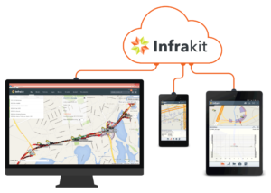
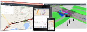
Infrakit Cloud connects all devices on the construction site in real-time.

Infrakit is a digital system for efficient project management in infrastructure construction.

It is also the winner of Finnish Quality Innovation of the Year 2015 competition and came second in the same category in the International Quality Innovation competition.

Case Tietomekka: Ditch the Unnecessary and Get Efficient

“Digitization changes infrastructure industry work methods in many ways, and challenges learning. The ones who resist change in the beginning usually notice the benefits and competitive advantages later, too.” says CEO of Tietomekka, Keijo Pulkkinen.

“We have been recognized for our innovativeness and business enabling software and services that benefit customers through growth in efficiency, savings and customer service development. Autori software is based on wireless data transfer, geolocation and map-based data management including apps for on-site and office use at different phases of a project. Digitization improves collaboration and efficiency for contractor activities and adds value to their operations.”

“Employees can concentrate on their core expertise when there is less unnecessary work, like data gathering and reporting.”
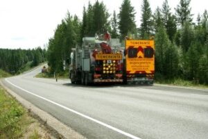
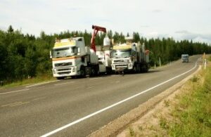
 

Digitization is already an important part of road marking. It makes work more efficient, saves time and money, and develops collaboration.

Case Lemminkäinen: From Data Hunting to Data Management

“When information is shared between software and from an office to another and/or to worksites, design and construction quality improves, communication is easier and there are fewer mistakes” says Kyösti Ratia, the Technical Manager of Lemminkäinen Infra Ltd.

“For example, the wasting of resources has reduced because of improved work quality, thanks to machine automation. Over-digging has decreased, which means less filling and less work for dump trucks. The use of IM3 format has improved surveying quality and changed land surveyors’ work content.”

“As an example I can mention a worksite, where fuel consumption of excavators increased circa 30% – they were simply working more because they didn’t have to wait for measurements to be implemented. Now excavators work more precisely – tolerances are just within few centimetres compared to the previous 10-15 cm. Traditional data hunting and data “dumbifying” should be in the past. You have an access to years of planned work, gathered data and solutions – so why only the tip of the iceberg is taken to the next level?”

“The challenge is data reliability. You can find the person responsible for it – and for work safety – by taking a good look in the mirror.”

Case VR Track: Activist, follower or avoider?

“Digital revolution affects all organisational and personal levels – from managers to railway track workers”, says the Development Manager of VR Track Ltd Jouni Kekäle.

“In every-day life digitization can be seen, for example, for railway track workers that they now use mobile apps and GNSS devices instead of rods. In infra-construction industry there are several projects where BIM clearly improved productivity, e.g. Lielahti-Kokemäki track project, Pisararata design, Tampere tram project and Äänekoski factory accessibility track project.”

“The question now is how to take part in the digital revolution – being proactive, follow others or just avoid it? Opportunities and risks will result according to the role you have chosen. Being a follower or avoider ends up badly. If you want to stay competitive you have to jump on top of the digitization wave in one way or another. Also, it’s not enough just to acquire new digital devices and apps for the worksite, you have to invest in personnel training and implementation too.”

“Digitization has become the core of our strategy. We want to be active in the frontline of the industry development, which requires us to be unbiased, agile and open to try new things.”

Source: INFRA – Infra Contractors Association in Finland, infra.fi / original article appeared in Finnish for Infra magazine, infra.fi/lehti
Book a Demo

Discover how Infrakit connects your entire infra project operations and drives value to every part of your business.

Belgrade’s Infrakit Day

Belgrade’s Infrakit Day

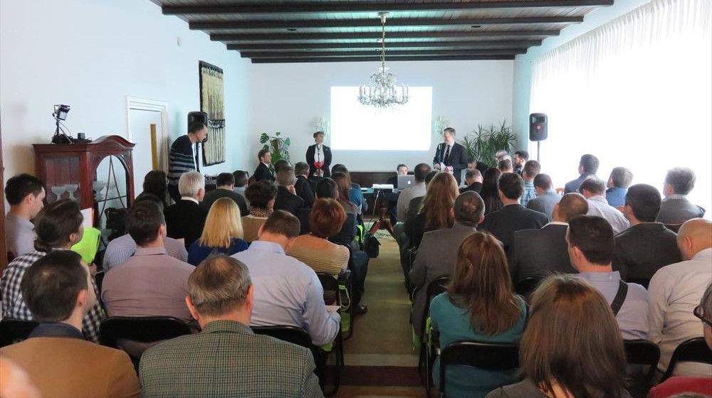
We successfully organized a promotional and educational Infrakit Day event in association with the Embassy of Finland in Belgrade on 29th of February at the Finnish Residence Serbia:

Digital Innovations in Finland – New technologies in civil construction and practice

Focus of the presentations was on the IT part to explain how we make civil construction digital. We also spoke about how we collect data easily from construction sites and how we use this to build a digital world with Infrakit cloud.

Event exceeded our expectations. We were prepared for 50 participants, but over 70 arrived, which was a very pleasant surprise! Apparently this issue is a very hot topic across the industry. We also had support from Civil Construction Faculty for our lecture with two speakers.

Since we had short time for our presentation, we invited our guests for further discussion of Infrakit’s practical use and benefits for people in civil construction. As the discussion continued we saw that there is a desire for even more detailed presentation at those companies’ facilities. A promise we were eager and happy to make.

At the end of our presentation, we invited Serbian civil construction industry to join digitization and explain to authorities how easy it is to make “Fourth Industrial Revolution” happen. With Infrakit it is easy for Serbia and other developing countries, as there is no need for vast initial investments or acquiring of expensive machinery – what you need is your on PC and/or Android tablet with Internet connection.

You can read further about the Event at Finnish Residency internet site here. Thanks again to all participants, speakers and Embassy of Finland in Belgrade!

Book a Demo

Discover how Infrakit connects your entire infra project operations and drives value to every part of your business.

Surveying Tool in your Tablet

Surveying Tool in your Tablet

Infrakit App has a new feature: “surveying” tab.

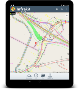
Infrakit App on a Table

Location data and surveying features were earlier under “advanced mode” tab. Now land surveying is made even easier so that every App user has an access to centimetre-precise location data from an external GNSS device.

If you don’t need so precise location for some tasks, you can use your Android device’s own GPS sensors or external GNSS device with DGPS location free-of-charge service provided by National Land Survey of Finland. Land surveying becomes real-time when you can do that while also designs and as-built data are shown on the same screen on the Infrakit platform.

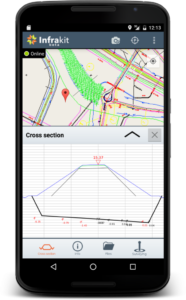
New User Interface with Cross Section (mobile)


Infrakit App supports most GNSS devices, such as: Javad, Topcon, Leica, Trimble, CHC, Stonex, Spectra Precision and more.

It’s now also possible to share your location in the App. That means that any Android device – tablet or mobile – equipped with Infrakit App is shown on the map, for example as excavator or truck icon. This way machinery or even a staff member can be a part of Infrakit map view.

We are developing Infrakit App continuously, so please make sure that you have the newest version updated on your device. Read about some user experiences here and the App launch (June 2015) from here.

Book a Demo

Discover how Infrakit connects your entire infra project operations and drives value to every part of your business.